Khao Chot Subdistrict Municipality lies within the western mountain range, within the boundaries of Chalerm Rattanakosin National Park, Srinakarin Dam National Park, and a national reserved forest area. The terrain is generally rugged, mostly limestone mountains, ranging from 240 to 1,260 meters above sea level. Notable peaks include Khao Kamphaeng, Khao Mai Hom, Khao Phu Chang Mop, and Khao Bandai Chang, with the highest point at Khao Kamphaeng reaching approximately 1,260 meters. These mountains are the source of streams such as Huai Mae Phlu, Huai Takuat, and Huai Kraproi, covering a total area of 922 square kilometers (about 576,250 rai). The area borders neighboring localities and provinces as follows: to the north, Kaen Makrut Subdistrict, Ban Rai District, Uthai Thani Province; to the south, Nong Ree Subdistrict, Bo Phloi District, and Dan Mae Chalaep Subdistrict, Si Sawat District, Kanchanaburi Province; to the east, Wang Yao and Ong Phra Subdistricts, Dan Chang District, Suphanburi Province, and Somdet Charoen and Nong Prue Subdistricts, Nong Prue District, Kanchanaburi Province; to the west, Na Suan Subdistrict, Si Sawat District, Kanchanaburi Province.

Highway 3199 (Kanchanaburi to Si Sawat) is known as a "scary" or dangerous route because it passes through forested areas where wild elephants frequently cross the road to forage, especially at night. The road is winding, with some isolated stretches that make drivers exercise extra caution.

Opinions from Pantip web forum
1....The route from Mueang District heading to Si Sawat District, around the uphill section at Tap Tao, just past the entrance to Srinakarin Dam, is highly recommended to travel during daytime. Firstly, it is a dangerous route, and secondly, many encounters with what are called spirits or ghosts are reported, in various forms. The most common sighting is a person sitting on the road barrier, but when you drive past, you see the same person repeatedly along the way, suggesting it is not a real person.
2.....The 3199 route beyond the ferry crossing area heading into Si Sawat District doesn’t have ghosts, but it is isolated, winding along forest and mountain edges with no streetlights or houses. It is dangerous because wild elephants are present. Few people use this route during the day, and at night it is definitely too scary to consider.
3.....The route from Mueang District heading to Si Sawat District, around the uphill section at Tap Tao, just past the entrance to Srinakarin Dam, is highly recommended to travel during daytime. Firstly, it is a dangerous route, and secondly, many encounters with what are called spirits or ghosts are reported, in various forms. The most common sighting is a person sitting on the road barrier, but when you drive past, you see the same person repeatedly along the way, suggesting it is not a real person.

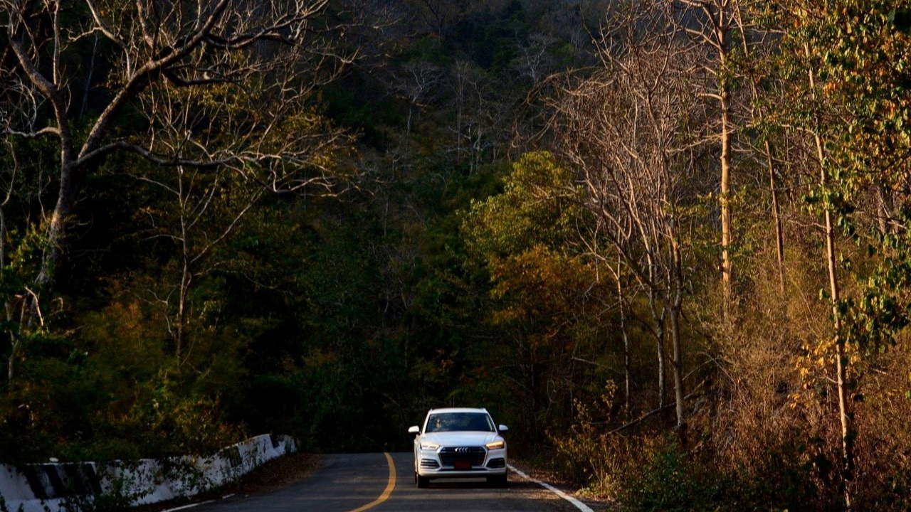
4....Last Sunday I went to stay on a raft in Kanchanaburi, several kilometers past Srinakarin Dam. I had urgent business and had to return to my grandfather’s home in Ban Rai District, Uthai Thani. I used Google Maps, which directed me along this route. I started traveling at 5 p.m. (I later learned there was a ferry crossing to Si Sawat District, but I’m not local). Traveling after dark on Highway 4041, as shown in the photo, was both eerie and frightening (the eerie feeling actually began on route 3199 around the dam area, but since it was still light, it wasn’t as intense). The road climbs nearly all the way, and I was shaking because I was driving an eco car (Yaris Ativ). I couldn’t drive fast because it was dark and the curves were sharp. I was driving alone and confess that I have never been so scared while driving in my life. Locals might say it’s normal and that the route is less scary during the day, but at night it’s really intense. I rate this as one of the spookiest roads. It also made me realize I need to be more careful when traveling, even if this route shortens the journey by nearly 80 kilometers. I won’t take it again.

Opinions from the Jompran Facebook page
1....This is a natural conservation route. I guarantee anyone who goes there will never forget it. On the left side, there is a view of the reservoir; on the right, natural forest. Along the way, there are streams, waterfalls, and natural fishing spots with tents set up by the reservoir. I have been there dozens of times and never get bored.
2......I once rode a bicycle through the area with a group. Locals warned us to be careful of wild elephants. It was probably almost ten years ago. The route is very beautiful with good roads and little traffic.
3......I once drove alone along the route from Tham Than Lod Waterfall through Si Sawat. There were a few houses, no oncoming cars, and no one following me, even during daytime. At night, I wouldn’t dare. Elephant tracks and droppings covered the road. The road is isolated but fun to drive, testing the car on tight curves and steep hills. I recommend going in a group with several vehicles and using radios to stay in contact.

4.......I lived in Khao Chot in 1978, 47 years ago. The village had about 10 households. When I stayed there, we used two routes: one through the end of Na Suan passing Wat Tham Ong Juk, which took 3 to 4 hours on foot, crossing 13 hills. At that time, wildlife was abundant. The other route followed a logging trail to Ban Tha Lam Yai or cut across to Tha Tham Lod Yai Waterfall, passing the Tri Trin Sala Waterfall and Tha Tham Lod Noi, exiting at Tha Lam Yai. I walked this route with a monk collecting alms, taking a bit over 2 hours. We returned to the temple around 11 a.m., having had only one meal. The main route from Khao Chot in the morning would reach Tha Lam Yai by evening, covering 51 streams and 42 kilometers.
5........I have driven this route 3-4 times to see for myself and to carry out tasks related to the legendary tales of "Territorial Ghosts and Elephants" as told by officials from Salak Phra and Chalerm Rattanakosin National Park.

6.........I just went last month and I really loved it. I was the only car on the road; no oncoming vehicles. The forest is well preserved, ideal for slow driving to observe birds, butterflies, and wildlife. However, it is quite isolated, so I don’t recommend going alone — bring friends. The scenery is beautiful, and the atmosphere feels like being abroad. After this route, passing through Si Sawat and over the mountains, the road is stunning as it descends toward Suphanburi and loops back to Bangkok. It’s a must-visit.
7......I’ve been several times. Once, I saw 6-7 elephants standing in the bushes, which almost made me pee myself. The last time, in March, I saw three serows on the road, probably calves. When I approached, they jumped into the forest. This route is nice around the bridge section. It goes up Khao Chot, then down to Nong Prue and Nong Ree, exiting at Dan Chang.

Reasons why people say the route is scary or dangerous:

Precautions when using Highway 3199: