Japan is closely watching two storms after Typhoon Mekkhala moved over the sea east of the Philippines with a tendency to approach the Okinawa Islands before heading toward western Japan. Meanwhile, Tropical Storm Higos has newly formed near the Mariana Islands and is also expected to move toward western Japan. Meteorologists warn that moisture from these storms may trigger heavy rainfall before landfall.
The Japan Meteorological Agency (JMA) reported weather developments requiring close monitoring as two typhoons are simultaneously moving toward Japan. This may cause heavy rains, strong gusty winds, and high waves in many areas over the coming weekend.
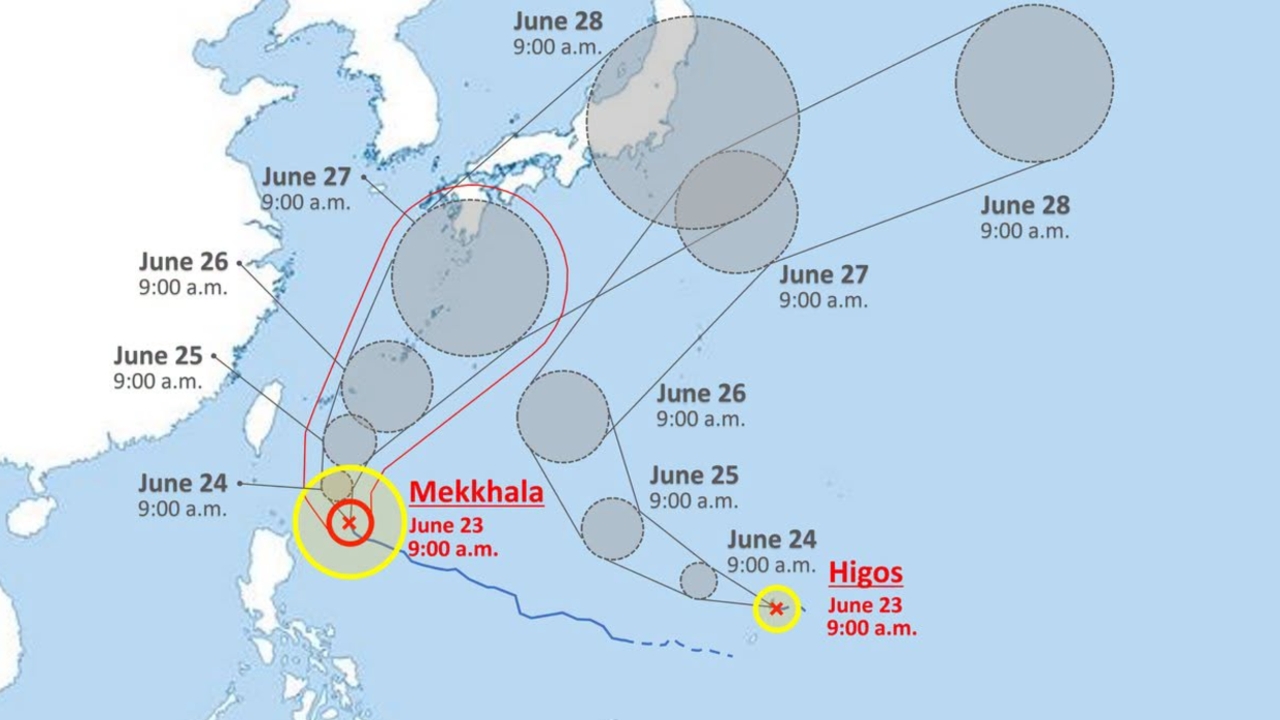
Typhoon Mekkhala, or Storm Number 7, remains at a "very powerful" intensity while moving east of the Philippines, with a central pressure of 925 hectopascals. Maximum sustained winds near the center reach 50 meters per second, with gusts up to 70 meters per second. It is expected to approach Okinawa Island on 27–28 June before moving toward northern and western Pacific coastlines of Japan. The storm is forecast to gradually weaken as it nears the mainland.
At the same time, the JMA announced the formation of Tropical Storm Higos (Number 8) near the Mariana Islands, with a central pressure of 1,004 hectopascals and maximum sustained winds near the center of 18 meters per second. It is moving westward at 15 kilometers per hour. Higos is expected to move north faster than Mekkhala but is unlikely to approach Honshu, Japan's main island, closely.
Weather models from Japan (GSM), the U.S. (GFS), and Europe (ECMWF) show differing forecasts on the storms’ exact paths due to another developing low-pressure area following behind. Experts are watching closely for a possible Fujiwhara Effect—where two nearby cyclones rotate around each other and influence each other's paths and moisture flow. This could cause the storms to shift toward the Sea of Japan to the west or veer eastward into the Pacific Ocean.
The greatest concern currently is not just the direct impact of the storms but the vast masses of warm, humid air they are drawing upward, which will stimulate the existing seasonal rain front crossing Japan. This will result in dense cloud formation and immediate heavy accumulated rainfall, especially on the Pacific side of Kyushu and Shikoku islands.
Authorities have issued warnings for residents to be cautious of rising river levels that may overflow, as well as heightened risks of landslides and flash floods. People are advised to avoid hazardous areas such as mountain slopes and riverbanks. Additionally, sea waves are expected to intensify, with the southern Sakishima Islands near Okinawa facing waves as high as 4 to 6 meters.