

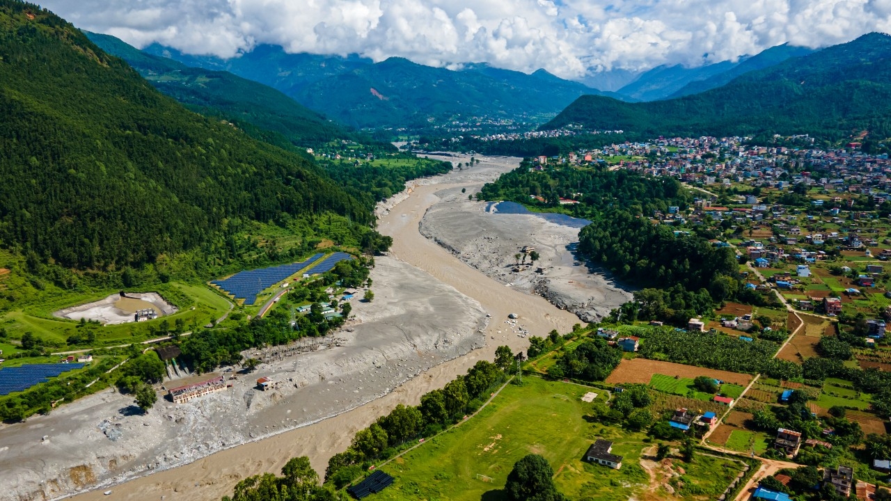
A recent study found that construction in hazard-prone areas of the Himalayas is rapidly expanding, especially in flood-risk zones near glacial lakes. Built-up areas increased nearly 78% between 2016 and 2023, while at least 300,000 people may live in these risk zones amid global warming accelerating glacier melt and raising the threat of floods, landslides, and other disasters.
A study published in the journal Scientific Reports states that at least 300,000 people in parts of the Himalayas may reside in disaster-prone areas. Researchers found built-up areas in northern Nepal's hazard zones, parts of southeastern Tibet, and Uttarakhand state in northern India increased about 45% from 2016 to 2023. Meanwhile, constructions in glacial lake flood-risk zones rose nearly 78% during the same period.
The researchers noted that the actual number of people at risk may be much higher, since the study covered only designated areas and did not include nearby zones facing similar threats.
This research was conducted before the major floods in Nepal last August that killed over 1,400 people and left thousands missing. Since then, several smaller disasters have occurred, including flooding along the Budhi Gandaki River on 11 October, which damaged 200 homes, destroyed five bridges, and left five people missing.
Nine researchers from the UK, Nepal, and India studied river corridors in the Himalayas, covering up to 50 kilometers inland along river flow directions, including areas around approximately 1,360 glacial lakes. They found significant expansion of built infrastructure such as tourist sites, infrastructure, and real estate projects.
Pokhara, a major tourist hub near the Himalayan foothills, has grown substantially over 30 years to accommodate more visitors. However, urban development has made managing risks from the Seti and Gandaki rivers a major challenge.
Thanaraj Acharya, Mayor of Pokhara, said the river originates from the Annapurna Mountains and flows through the city, with many old buildings situated just 5 meters from the riverbank. Despite new regulations requiring greater setbacks from the river, he said the real challenge is deciding where and how to relocate these structures.
North of the city lies the Annapurna trekking route, renowned worldwide, where riverside communities have also expanded. Some areas have experienced flooding and landslides recently.
Furpa Shiring Lama, a local homestay operator, said his 20-room facility used to be fully booked during peak trekking season, but now only five rooms are occupied. He said his family has run the business for over 40 years but has never faced such severe disasters before.
Meanwhile, Krishna Gaushan, owner of a hotel near the Modi River fed by glaciers, expressed concern that if glaciers collapse or glacial lakes burst, the river could overflow, forcing residents to live in constant fear.
Kagendra Paudel, a geographer at a campus of Tribhuvan University in Nepal, observed that some tourism investors promote these areas without considering disaster risks. This problem is similar to northern Himalayan valleys in India, which are important pilgrimage sites.
Laxman Subedi, president of the Pokhara Hotel Association, acknowledged tourism growth in the region has lacked proper planning and has been promoted chaotically. The association is now trying to raise awareness among operators and investors but warned that once disasters strike, it may be too late to fix the damage.
Beyond tourism, areas around the Bhote Koshi and Trishuli rivers have also seen significant increases in hydropower construction.
Scott Watson, a glaciologist from the University of Leeds in the UK and lead researcher, warned that as river valley populations grow denser, current development decisions will affect disaster risk levels for decades.
The study classified buildings within 50 meters elevation from river or glacial lake surfaces as at risk, but the severe flood on 26 August showed water levels in some parts of the Rasuwa area could reach up to 70 meters, according to local residents.
This caused buildings located a fair distance from riverbanks to be flooded and buried under debris and mud, so the actual number of buildings at risk may exceed the study's estimates.
The main cause of these risks is global warming in the Himalayas, where scientists say temperatures are rising about twice as fast as the global average. This accelerates melting of glaciers, ice fields, snowpacks, and permanently frozen soils.
The melting destabilizes already fragile slopes, which also experience frequent earthquakes, potentially triggering severe disasters affecting downstream communities.
Additionally, melting ice causes glacial lakes to expand and fill, which can eventually burst, causing severe floods. Nepal has recorded about 30 such events since 1940.
Higher temperatures also increase rainfall at high elevations, where snow used to fall, leading to slope failures, rock and ice avalanches, and other disasters.
Nepal's Prime Minister Balendra Shah addressed climate change risks at the recent UN General Assembly, stating his country pays a heavy price for crises it did not cause. He warned that each major disaster could destroy years of development progress and force poor nations into debt to rebuild damages they did not create.
Alton Byers, a mountain geographer from the University of Colorado not involved in the study, said the research should be a starting point for developing more effective early warning systems and disaster prevention measures.
However, efforts face challenges as activists report building regulations are poorly enforced in practice, while many developments have proceeded for years without clear direction.
Professor Suriya Raj, an urban planning expert and registrar at a Nepalese university, said roads, hydropower plants, hotels, and commercial communities have expanded along river lowlands due to accessibility and suitability. However, responsible parties often neglect protective measures like riverbank setbacks.
He warned that fragile ecosystems like the Himalayas require stricter urban planning and construction regulations than other areas, but so far these rules remain weak and poorly enforced.
Nepalese agencies said they are working to address the issue. The National Disaster Management Office plans to ban settlements within 15 meters of riverbanks along the heavily damaged Rasuwa-Bhote Koshi corridor and intends to apply similar measures to other river areas.
Thammarat Upreti, CEO of the agency, said the effort is difficult because many people have strong emotional ties to their land and property, but the increasing risks cannot be ignored.
Similar problems occur in India's Uttarakhand state bordering western Nepal. Environmental activist Anup Nautiyal said tourist limits and environmental regulations are ignored to promote economic growth.
Although laws mandate land-use zoning and prohibit building too close to riverbanks, he said enforcement is weak and widespread construction continues unchecked.
On 12 October, Uttarakhand's government approved new flood zone regulations to control land use and development, aiming to protect lives, property, and infrastructure from potential flood damage while preserving natural flood flows.
However, Basanta Raj Athikari, director of the Disaster Studies Center at Tribhuvan University, believes these risks cannot be fully eliminated.
He suggested risk-level mapping to guide insurance coverage as another approach. If authorities classify areas as high, medium, or low risk, insurers could tailor protection accordingly, encouraging people to build in safer locations with suitable coverage.
Nevertheless, construction across the Himalayan region shows no signs of slowing down so far.
SourceBBC