

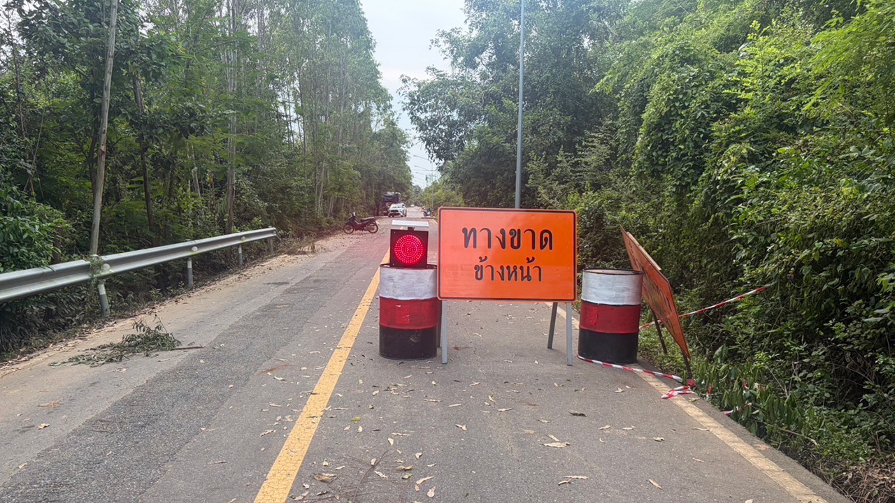
The Department of Rural Roads revealed that 11 routes in Prachinburi province are severely affected by flooding and road collapses, making them impassable. Officials are mobilizing teams to assist residents around the clock.
Mr. Phichit Hunsiri, Director-General of the Department of Rural Roads, revealed that the Department of Rural Roads (DRR) has mobilized staff and resources including trucks and machinery to assist flood victims nationwide, focusing especially on eastern provinces like Prachinburi.
According to reports from Rural Highway Office 13 (Chachoengsao) and Prachinburi Rural Highway District, 11 rural road routes in Prachinburi have been heavily impacted and are currently impassable due to high water levels and damaged, collapsed sections. Residents are advised to avoid these routes for safety.
1. Route P.C.3017 from Highway 319 junction to Ban Inthanin, Mueang Prachinburi District, from km 0+000 to 2+000, water depth 100 cm.
2. Route P.C.4025 from Highway 3452 junction to Ban Thangam, Mueang District, km 0+000 to 4+110, water depth 80 cm.
3. Route P.C.5050 from rural highway junction P.C.4025 to Ban Sang intersection, Mueang District, km 0+000 to 25+656, water depth 100 cm.
4. Route P.C.4014 from Highway 3347 junction to Khok Pib, Ban Sang and Si Maha Phot Districts, km 0+000 to 13+000, water depth 70 cm.
5. Route P.C.3022 from Highway 319 junction to Ban Wang Khon, Mueang and Ban Sang Districts, km 0+000 to 16+776, water depth 70 cm.
6. Route P.C.4028 from Highway 3347 junction to Bang Tan, Ban Sang District, km 0+000 to 16+918, water depth 80 cm.
7. Route P.C.4036 from Highway 3347 junction to Khlong Hua Krot, Ban Sang District, km 0+000 to 13+114, water depth 70 cm.
8. Route P.C.4044 from Highway 3078 junction to Ban Prachantakham, Mueang District, with road collapses at km 11+500 to 11+550, 14+800 to 14+900, and 20+100 to 20+200.
9. Route P.C.2042 from Highway 33 junction to Ban Wang Wai, Kabin Buri District, with road collapses at km 2+500 to 2+600, 3+500 to 3+550, and 3+700 to 3+900.
10. Route P.C.4043 from Highway 3078 junction to Ban Tha Sao, Si Maha Phot and Kabin Buri Districts, with road collapses at km 1+700 to 1+800, 11+500 to 11+600, 13+350 to 13+750, and 14+250 to 14+300.
11. Route P.C.4013 from Highway 3078 junction to Ban Nong Kho, Kabin Buri District, flooded at 70 cm depth at km 0+000 to 5+000, 15+600 to 18+200, and 19+200 to 19+700.

The DRR continues to provide ongoing support by relocating bedridden patients and delivering food, drinking water, and essential supplies to homes and flood relief centers. Water trucks are distributing water to residents, and collaboration with local agencies has organized truck transport to ferry residents in flooded areas, aiming to alleviate hardships and boost morale until the situation improves. Residents can report flooding on rural roads via the DRR hotline 1146 or contact local rural highway offices nationwide, and follow updates onthe Department of Rural Roads, Ministry of Transport Facebook page.

Read more news " Government Policy " here.