The Earthquake Surveillance Division reported a 6.4-magnitude earthquake north of the Sumatra Islands, Indonesia, approximately 644 km from Mueang District, Satun Province. Tremors were felt in La-ngu District, Satun, and Palian District, Trang Province.
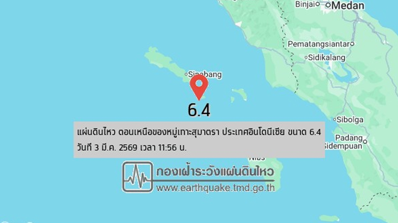
At 11:56 AM on 3 March 2026, the Earthquake Surveillance Division reported a 6.4-magnitude earthquake north of the Sumatra Islands, Indonesia, at a depth of 10 kilometers. The epicenter was located about 644 km southwest of Mueang District, Satun Province. There have been no initial reports of damage, but residents in La-ngu Subdistrict, La-ngu District, Satun Province, and Palian Subdistrict, Palian District, Trang Province, reported feeling the earthquake.
Meanwhile, the National Disaster Warning Center’s Facebook page posted that at 11:56 AM on 3 March 2026, a 6.4-magnitude underwater earthquake occurred at a depth of 10 km north of the Sumatra Islands, Indonesia, approximately 644 km southwest of Mueang District, Satun Province. Further information will be provided as it becomes available.
Ms. Wasitthi Sarapong, head of the Satun Provincial Disaster Prevention and Mitigation Office, stated that initially the tremors were felt in the following areas: Laem Son Subdistrict, La-ngu District, Satun Province, and Pak Nam Subdistrict, La-ngu District, Satun Province.
So far, no areas have been affected by the event. The earthquake and tsunami warning thresholds via the cell broadcast system are: for earthquakes in the Andaman Sea, magnitude 7.0 or higher; and for tsunamis, earthquakes in the Andaman Sea of magnitude 7.5 or higher at depths less than 100 km.
The Satun Provincial Disaster Prevention and Mitigation Command has ordered all agencies to monitor and watch the situation closely, prepare equipment, machinery, military assets, and personnel, and remain ready to provide assistance 24 hours a day upon request.