

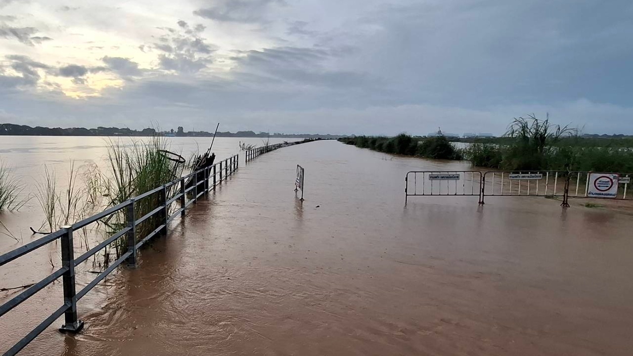
The Mekong River level passing through Bueng Kan province has continuously risen, surging to 12 meters and overflowing. The "Landmark Riverside Road". Officials are rushing to assist residents in five districts affected by the flooding.
At 06:00 on 10 August 2026, reporters observed that the Mekong River level flowing through Bueng Kan province has been rising continuously. This follows more than two weeks of persistent rainfall, combined with upstream water from Loei and Nong Khai provinces, as well as tributaries and accumulated water from Buffalo Mountain on the neighboring country's side. These waters flow down streams and main rivers on the Laos side, such as the Ngum, Ngeab, and Pak San Rivers, converging in Bueng Kan province, causing the Mekong’s water level to rise further and requiring close monitoring.

According to the National Water Resources Office's announcement, heavy rainfall occurred in Myanmar, Laos, northern and northeastern Thailand. The Mekong River water level is forecasted to rise by 1.0 to 1.5 meters between 8 and 12 August 2026. This morning, the water level at the Ban Phan Lam measuring point, Village No. 2, Wisit Subdistrict, Mueang Bueng Kan District, was 12.05 meters, 1.95 meters below the riverbank (which stands at 14.0 meters), an increase of 65 centimeters from yesterday.
This rising water level has caused the Mekong to overflow its banks, flooding the riverside "Landmark" road of the Bueng Kan provincial master plan development project along Khao Mao Road, covering about 500 rai. The water has surpassed the flood protection embankment, or the road in the middle of the Mekong River, over a stretch exceeding 2 kilometers, leaving only the steel barrier frames visible. Bueng Kan municipal officials have set up metal barricades to warn residents and have suspended use of the Landmark Road until the water recedes.
Meanwhile, tributary streams connected to the Mekong, such as A-Hong Stream in Hokham Subdistrict and Phak Khang Stream in Khai Si Subdistrict, Mueang Bueng Kan District, have experienced backflow from the Mekong. These streams have begun to flood agricultural areas across several villages. Relevant agencies are currently surveying the situation. Several village-connecting roads are also flooded, restricting light vehicle traffic. However, locals are taking advantage of the flooding to fish, providing food and reducing expenses.
In Seka District, in the subdistricts of Tha Kok Daeng, Tha Sa-at, Pong Hai, Nam Chan, Seka, and Sang, large volumes of floodwater have overflowed streams, inundating agricultural lands and many farm roads.
Similarly, in So Phisai District’s So, Nong Phan Tha, and Bua Tum subdistricts, the volunteer force of So Phisai District, together with local leaders, community leaders, and residents, have been helping affected villagers move valuables and belongings to safe places, while providing close support and encouragement to those impacted by the floods.

Additionally, in five other districts—Pak Khat, Phon Charoen, Bueng Khong Long, Bung Khla, and Si Wilai—floodwaters have inundated large agricultural areas. Relevant agencies are surveying and expediting aid to residents affected by this flooding.