

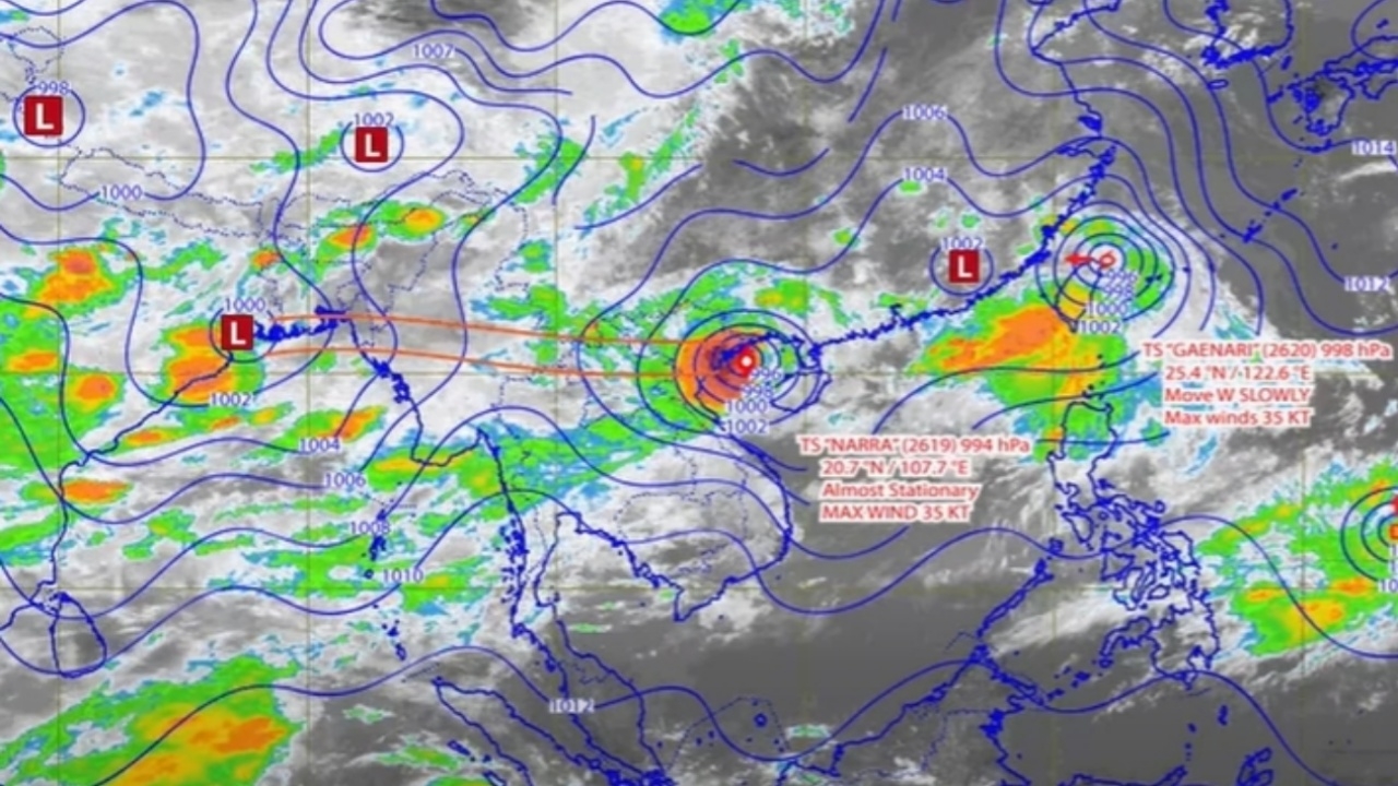
The Meteorological Department forecasts that over the next 24 hours, Thailand will experience thunderstorms and heavy rain in some areas, with rough seas and waves 2-3 meters high. Tropical Storm "Narra" in the Gulf of Tonkin is likely to move ashore in China on August 24-25, 2026, without directly affecting Thailand's weather patterns.
On 23 August 2026, the Facebook page "Meteorological Department" released weather forecast graphics by region along with maps showing areas at risk of hazards.
24-hour weather forecast Thailand will have thunderstorms and heavy rain in some areas of the north, upper northeast, central, and eastern regions. This is due to the monsoon trough crossing the upper north and upper Laos regions, entering Tropical Storm "Narra" in the Gulf of Tonkin. Additionally, a fairly strong southwest monsoon trough covers the Andaman Sea, Thailand, and the Gulf of Thailand. Residents in these areas are advised to be cautious of heavy and accumulating rainfall that may cause flash floods, flash floods from mountain streams, and river overflows, especially in foothill areas near waterways and lowland zones.
Regarding sea conditions, the upper Andaman Sea has fairly strong winds with waves 2-3 meters high, and in areas with thunderstorms, waves exceed 3 meters. The upper Gulf of Thailand has waves about 2 meters high, rising above 2 meters where thunderstorms occur. Mariners in the Andaman Sea and Gulf of Thailand should navigate with caution and avoid sailing in stormy areas. Small boats in the upper Andaman Sea are advised to refrain from going out to sea at this time.
Meanwhile, Tropical Storm "Narra" in the Gulf of Tonkin is expected to make landfall in southern Guangxi Province, China, between August 24-25, 2026. The storm will not enter Thailand and thus will not directly affect Thailand's weather. Travelers to the affected area are advised to check weather conditions before traveling during these dates.