

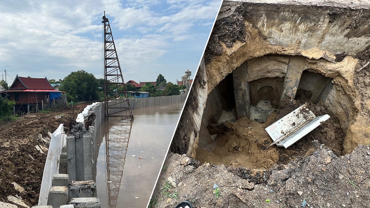
Ang Thong – Residents were alarmed when a wide area of ground at the joint of the riverbank protection dam along the Chao Phraya River subsided more than 3 meters deep, causing a stone picnic table to fall into the hole. Fortunately, there were no injuries. Meanwhile, the Chao Phraya River's water level continued to rise. Disaster authorities warned people in low-lying areas outside the embankment to move belongings to higher ground and relocate vehicles in preparation.
On 23 Sep 2026 GMT+7, reporters reported that residents of Village 6, Pho Sa Subdistrict, Mueang District, Ang Thong Province, were shocked to find a large circular ground subsidence over 3 meters deep along the Chao Phraya Riverbank. This occurred at the joint between the old and new riverbank protection dams, where a stone picnic table set had fallen into the hole.

Preliminary checks found this area is commonly used by residents as a resting and gathering spot, especially in the mornings and evenings. Fortunately, no one was present at the time of the subsidence, so there were no injuries. Authorities were promptly informed, including the village headman and related agencies.

Meanwhile, the Chao Phraya River's flow through Ang Thong Province has steadily increased after the Chao Phraya Dam in Chai Nat Province raised its discharge from 1,620 to 1,750 cubic meters per second at 15:00 GMT+7 (about 20 cubic meters per second increase). Continuous northern rainfall forced the dam to release water downstream, resulting in rising river levels through Ang Thong. Residents were urged to closely monitor official updates.
The Department of Disaster Prevention and Mitigation issued a warning message advising residents living in low-lying areas outside the embankments to move belongings to higher ground, relocate vehicles, and take special care of vulnerable groups.