

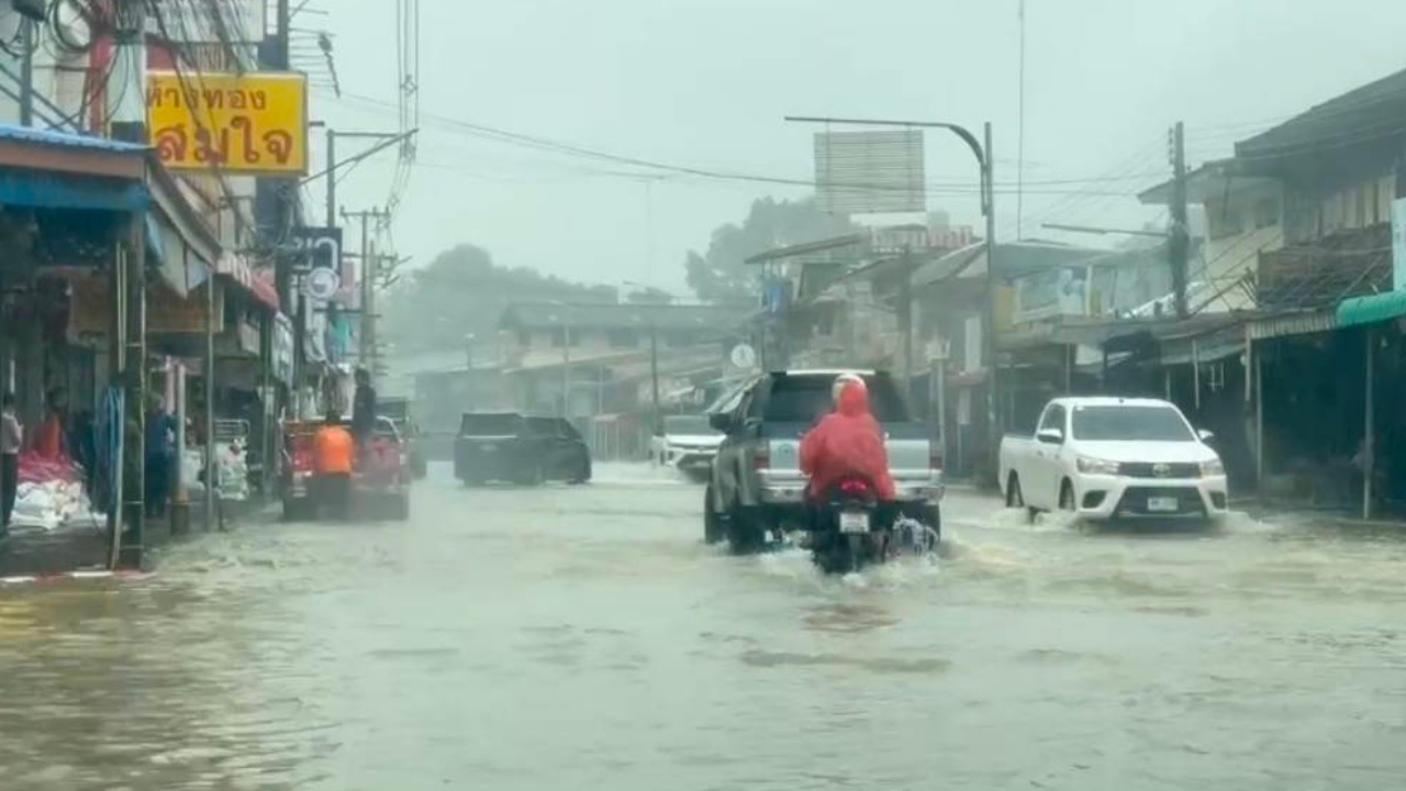
Sa Kaeo province has experienced flooding affecting seven districts, 22 subdistricts, and two community areas within municipal zones. Meanwhile, reservoir water levels continue to rise, reaching 65.27%, with close monitoring of Phra Sateng Reservoir as it exceeds its capacity.
Following a warning from the Meteorological Department about heavy to very heavy rain across all regions of Thailand, especially the eastern region, heavy downpours resembling a deluge have recently caused drainage systems to be overwhelmed, leading to flooding in multiple provinces and widespread damage to residential areas.
On 25 September 2026, reporters summarized the areas affected by the flooding situation in Sa Kaeo province.
Currently, Sa Kaeo province reports flooding impacts across seven districts, 22 subdistricts, and two community areas within municipal zones, detailed as follows.
1. Mueang Sa Kaeo District
Affected are seven subdistricts and one community area within Sa Kaeo town municipality, including:
1. Sa Kaeo Subdistrict
2. Sala Lamduan Subdistrict
3. Sa Kwarn Subdistrict
4. Tha Kasem Subdistrict
5. Nong Bon Subdistrict
6. Khok Pi Khong Subdistrict
7. Ban Kaeng Subdistrict
and a community area within Sa Kaeo town municipality.
2. Wang Nam Yen District
Affected are three subdistricts:
1. Thung Maha Charoen Subdistrict
2. Ta Lang Nai Subdistrict
3. Wang Nam Yen Subdistrict
3. Watthana Nakhon District
Affected are two subdistricts:
1. Non Mak Keng Subdistrict
2. Nong Nam Sai Subdistrict
4. Aranyaprathet District
Affected are five subdistricts and one community area within Aranyaprathet town municipality:
1. Tha Kham Subdistrict
2. Han Sai Subdistrict
3. Aranyaprathet Subdistrict
4. Fak Huai Subdistrict
5. Ban Mai Nong Sai Subdistrict
and a community area within Aranyaprathet town municipality.
5. Khlong Hat District
Affected is one subdistrict: Thai Udom Subdistrict.
6. Khok Sung District
Affected is one subdistrict: Nong Waeng Subdistrict.
7. Khao Chakan District
Affected are three subdistricts:
1. Khao Chakan Subdistrict
2. Phra Phloeng Subdistrict
3. Nong Wa Subdistrict
In summary, Sa Kaeo province has flooding impacts in seven districts, 22 subdistricts, and two community areas within municipal zones: Sa Kaeo town and Aranyaprathet town municipalities.
Meanwhile, the Sa Kaeo Provincial Public Relations Office page posted a situation update stating:
Water levels in Sa Kaeo reservoirs continue rising, reaching 65.27%, with close monitoring of Phra Sateng Reservoir as it exceeds capacity.
On 25 September 2026, the water situation in Sa Kaeo province showed that 17 reservoirs contain a combined volume of 175.13 million cubic meters, or 65.27% of total capacity, which is about 13.10 million cubic meters (4.88%) higher than at the same time in 2025.
Among three key reservoirs, Phra Prong Reservoir holds 49.850 million cubic meters, or 51.39% capacity, with no water release and recorded rainfall of 129.7 millimeters.
Khlong Phra Sateng Reservoir holds 84.632 million cubic meters, or 130.20% capacity, releasing 5.00 million cubic meters per day and spilling 7.897 million cubic meters daily via the spillway, with rainfall of 30.0 millimeters.
Huai Yang Reservoir contains 9.750 million cubic meters, or 16.25% capacity, releasing 0.04 million cubic meters per day, with rainfall of 35.0 millimeters.
Sa Kaeo province is closely monitoring water levels and releases from reservoirs and maintaining vigilance in vulnerable areas, especially lowlands and riverside zones, to prepare for any potential flooding.