

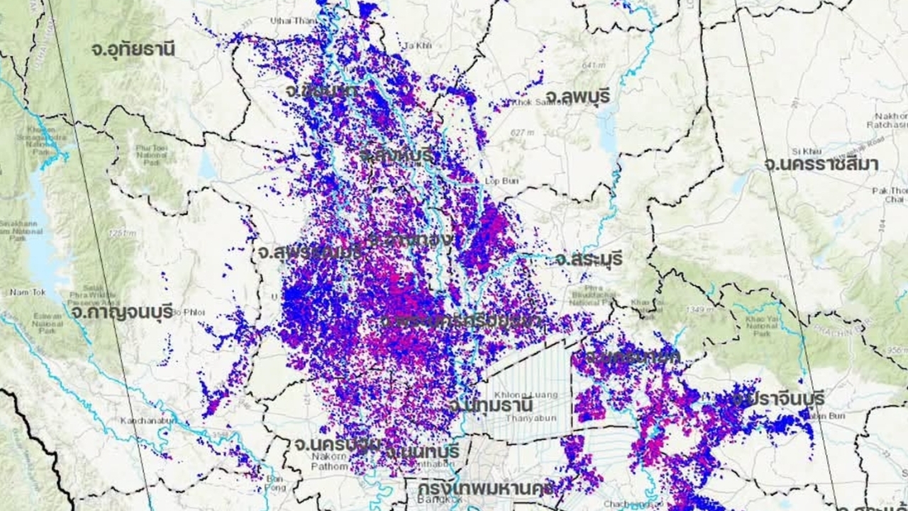
GISTDA has released Sentinel-1D satellite images revealing flooded areas in 29 provinces covering over 1.6 million rai, and has already forwarded the data to the main responsible agencies.
On 29 Sep 2026, it was reported that at 19:46 on the previous day (28 Sep), the fan pageGISTDA, the Geo-Informatics and Space Technology Development Agency (Public Organization)released data from the Sentinel-1D satellite dated 27 September 2026, showing approximately 1,631,394 rai of flooded land in parts of the Central, Western, and Eastern regions, including the provinces of Bangkok, Phetchaburi, Phetchabun, Kanchanaburi, Kamphaeng Phet, Chanthaburi, Chachoengsao, Chonburi, Chai Nat, Tak, Nakhon Nayok, Nakhon Pathom, Nakhon Sawan, Nonthaburi, Pathum Thani, Prachinburi, Phra Nakhon Si Ayutthaya, Phichit, Phitsanulok, Rayong, Ratchaburi, Lopburi, Samut Prakan, Saraburi, Sing Buri, Sukhothai, Suphanburi, Ang Thong, and Uthai Thani.
GISTDA has forwarded this information to the main responsible agencies to support management efforts according to their missions, including planning, monitoring, and ongoing assessment of the situation in the affected areas.
The public can follow additional flood updates at disaster.gistda.or.th and track the movement of water masses, hazard alerts, and local situations 24 hours a day via the “Check Water” application available on both iOS and Android systems.
Information from the fan page of GISTDA, the Geo-Informatics and Space Technology Development Agency (Public Organization).