

;
Thairath Online
Thairath Online

Bangkok Updates Latest Flooding Points on Main Roads: Where Traffic Is Passable and Where to Avoid

Local30 Sep 2026 10:38 GMT+7

Share

Bangkok Updates Latest Flooding Points on Main Roads: Where Traffic Is Passable and Where to Avoid

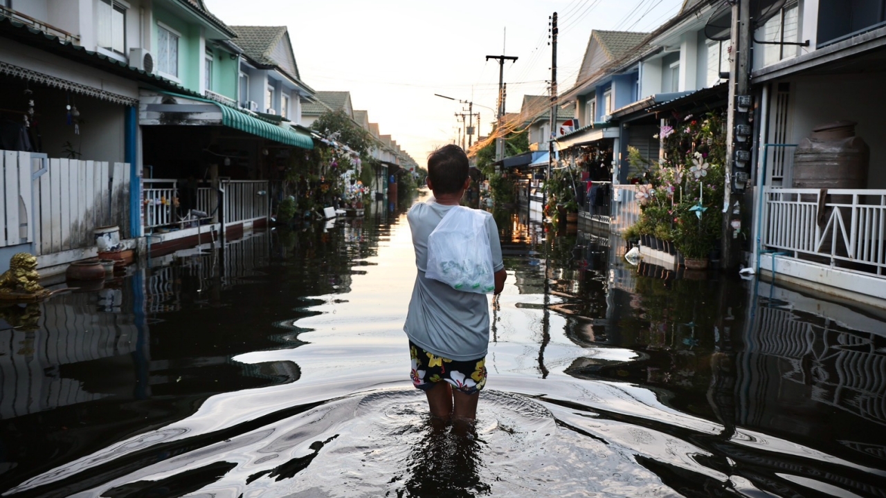
The Bangkok Flood Prevention Center updated the latest flooding spots on main roads as of 10:00 AM on 30 September, including alleys and villages, indicating areas with high water levels that should be avoided.

Following the recent flooding in Bangkok, the Flood Prevention Center updated the main road flooding points at 10:00 AM today.

  • Lat Phrao Road from Soi Lat Phrao 113 to Bang Kapi Intersection has 30 cm of water, traffic is prohibited.
  • Saranakhom Road in the middle of the alley, small vehicles should avoid.
  • Phahonyothin Road from Soi Sai Yud to the intersection with Theparak Road has water depths of 10-15 cm; in front of Phahonyothin 54/1 (Ying Charoen Market) to Phumipol Hospital 5 cm; from Km.25 Intersection to Phahonyothin 60/1 15-20 cm.
  • Ram Inthra Road at the entrance of Soi 5 has 5-10 cm; in front of Lumpini Boxing Stadium 10-20 cm; before Bang Khen roundabout 20 cm.
  • Lat Phrao Road from Soi Lat Phrao 113 to Bang Kapi Intersection has 20 cm of water.
  • Happy Land Road, Section 1, has flooding over two lanes.
  • Seri Thai Road from the intersection with Min Phatthana Road to Muang Min Intersection has 10-15 cm; at Suan Siam Intersection 10 cm.
  • Sri Burapha Road entirely has 30-40 cm of water; traffic is prohibited.
  • Srinakarin Road from Krungthep Kreetha Intersection to Suan Srinakarin has 10-15 cm of flooding.
  • Nawamin Road from Soi 38 to Bang Kapi Intersection has 20-30 cm of water.
  • Sihaburanukit Road from Muang Min Intersection to the bridge over Khlong Sam Wa has 15-20 cm; in front of Min Buri District Office 5-10 cm.
  • Suwinthawong Road from Muang Min Intersection to Nimit Mai Intersection (Wat Saen Suk Intersection) has 15-20 cm; from Nimit Mai Intersection to Rat Uthit Intersection inbound 20 cm, outbound 30 cm.
  • Chalong Krung Road from Chalong Krung 31 (Lat Krabang Industrial Estate) to Khlong Lam Ko Phai has 5-10 cm; from Khlong Lam Ko Phai to Suwinthawong Road 10-20 cm.
  • Chao Khun Thahan Road from Rom Klao Road Intersection to Chalong Krung Intersection has 10-20 cm.
  • Lat Krabang Road from Lat Krabang Rom Klao Intersection to Khlong Hua Takhue has 10-40 cm.
  • Luang Paeng Road in front of Lotus Lat Krabang has 30-40 cm; from Khlong Chorakhe Noi Intersection to Khlong Khlong Intersection 10-40 cm.
  • Rat Phatthana Road is flooded along the entire stretch but remains passable.

Meanwhile, alleys and communities still experiencing high water levels include:

  • Kheha Khlong Chan.
  • Kheha Rom Klao.
  • Soi Ramkhamhaeng 60 with water levels of 50-70 cm.
  • Soi Khubon 27.
  • Uea Arthorn Bueng Kum at the exit, middle, and end of the alley should be avoided.
  • Soi Seri Thai 41 and 43, small vehicles are prohibited.
  • Suwinthawong 96 has high flooding.
  • Laem Thong Athlete Village.
  • Luang Paeng Community.
  • Soi Ram Inthra 117 in Min Buri has 30 cm of water.
  • Pruksa Ville 50/1 on Rat Phatthana Road.

Further updates will be reported accordingly.