

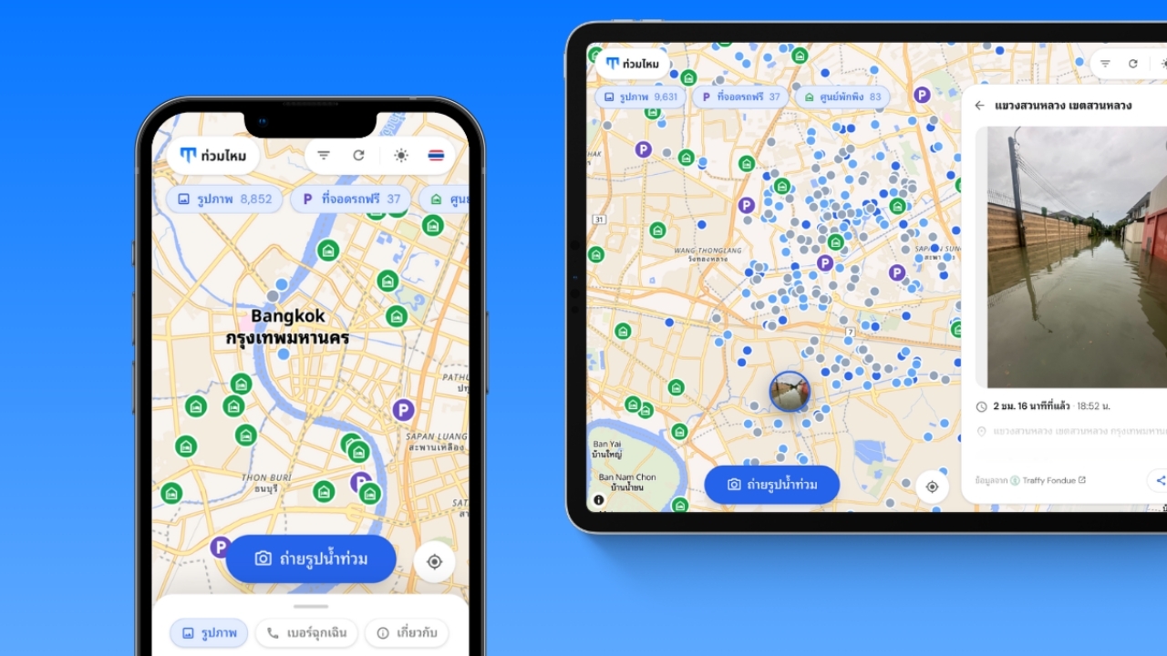
Chulalongkorn University students developed the “Tuammai” website.https://tuammai.com/A real-time map showing flooded locations that also helps users plan the best routes before leaving home.
Following recent flooding in Bangkok and its metropolitan area, Chulalongkorn University students developed an innovative real-time flood image map called “Tuammai” (tuammai.com). It enables the public to see current road conditions, recommends the best routes to avoid flooded areas, and indicates nearby free parking and shelter locations. The service has been free since 27 Sep 2026, with over 20,000 visits within the first 48 hours after launch.
Polawat Sirijindaphirom, a second-year student at Chulalongkorn University's Integrated Innovation Institute (CSII) and the developer of this innovation, explained that the idea arose from a common question among Bangkok residents during flood crises: “Are the routes to various places flooded, and can vehicles pass?” While weather forecasts only report rainfall amounts in millimeters and real-time data is scattered across chat groups and news feeds, the “Tuammai” innovation consolidates these answers on a single map.

Polawat said, “During crises, the knowledge and skills we gain as Chulalongkorn students must serve society. When flooding occurred, I was uncertain which routes vehicles could safely use without damage. Although Bangkok has thousands of flood images reported by citizens through Traffy Fondue, each with location and time data, no one had mapped them all for public viewing. I created “Tuammai” so everyone can know before leaving home which routes are safe. Helping even one person avoid driving into unseen floodwaters is worthwhile.”
The standout feature is flood-avoidance navigation: by entering a destination, the system displays all reported flooded points along the route and suggests the best alternative path. This helps users plan ahead and avoid encountering floods en route.

At its core, Tuammai offers a live flood image map by continuously pulling flood reports submitted by citizens via Traffy Fondue, Bangkok's problem-reporting platform. All images are placed exactly where and when taken. At launch, there were over 10,000 images. Users can tap images to view full photos, times, locations, and reporter comments, filter by district or time, and instantly share links.
Additionally, those at flooded locations can add images to the map within about 20 seconds by taking live photos, indicating water depth, and specifying whether cars, motorcycles, or pedestrians can pass. The system does not accept images from archives; all photos are taken in real time at the actual location and time.
“Tuammai” also compiles free parking spots offered by agencies and shopping centers for moving vehicles to higher ground, as well as temporary shelters established by Bangkok authorities. Each location details capacity, opening hours, managers, phone numbers, and includes navigation buttons via Google Maps, all based on official announcements. An emergency tab gathers phone numbers for police, fire and rescue, emergency medical services, Erawan Center, Bangkok Hotline 1555, and disaster hotlines, allowing users to call directly with one tap.

A notable aspect of “Tuammai” is that it is a website requiring no app installation, supporting both Thai and English, with no membership registration or user tracking. User location data stays on their device unless they choose to submit images. The service is accessible via the website.https://tuammai.com/