

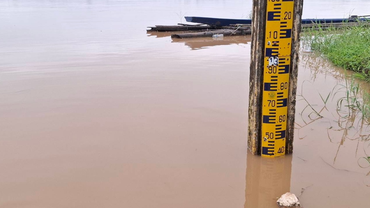
"Bueng Kan Province" is the focus. The Mekong River has risen continuously by another 30 centimeters, causing floods in 7 districts and submerging 16,000 rai of farmland.
At 06:00 on 11 August 2026, reporters reported that the Mekong River level flowing through Bueng Kan Province continues to rise steadily. This is due to water masses coming from Loei and Nong Khai provinces, tributaries, and accumulated water from Buffalo Mountain on the neighboring country's side, flowing through tributaries and main rivers in the Lao PDR side such as the Ngum, Ngeab, and Pak San rivers, converging in Bueng Kan Province, causing the Mekong's water level to rise further.
This morning, the water level at the Ban Pan Lam measurement point, Village No. 2, Wisit Subdistrict, Mueang Bueng Kan District, was 12.38 meters, 1.62 meters below the riverbank (14.0 meters), rising 33 centimeters from yesterday.
Meanwhile, large amounts of debris including branches and aquatic plants have been swept against the water pumping rafts in Pak Khat District. Officials have been continuously pushing debris away to prevent damage and have kept water production running to ensure residents have normal water usage.
The Provincial Waterworks Authority, Phon Phisai branch, announced a temporary water supply shutdown in Pak Khat District due to damaged water production systems. Repairs will take the entire day.
At the Mekong riverside at Lan Phaya Nak area in Pak Khat District, water levels remain in the watch zone, 1.20 meters below the riverbank. Pak Khat District and Pak Khat Municipality have warned riverside residents to closely monitor updates and be ready to move belongings to higher ground immediately if alerted.

The Nong Phanta Subdistrict Administrative Organization in So Phisai District quickly distributed survival bags containing rice, dry food, and drinking water to 27 affected households. Similarly, Bua Tum Subdistrict Administrative Organization provided survival bags to alleviate initial hardship, offered encouragement, and is urgently seeking solutions to flooding issues in several parts of Bua Tum to plan urgent assistance for affected residents. The rising water levels have also impacted livestock, especially cattle, which have lost grazing areas due to widespread flooding.
Mr. Surapol Charoenphum, Governor of Bueng Kan Province, said the flooding and water surges in the province are caused by over three weeks of rainfall and Mekong backflow. Initial reports from the provincial agriculture office indicate that agricultural areas in 7 districts—Mueang Bueng Kan, So Phisai, Sri Wilai, Seka, Pak Khat, Bung Khla, and Bueng Khong Long—covering 32 subdistricts, 102 villages, and 1,478 households, totaling over 16,654 rai (mostly rice fields), have been affected but not yet damaged. No reports have come from Phon Charoen District yet.
He also instructed local authorities to prepare funds to assist villagers who suffer total damage after surveys, stressing that only registered farmers will be eligible for aid.