

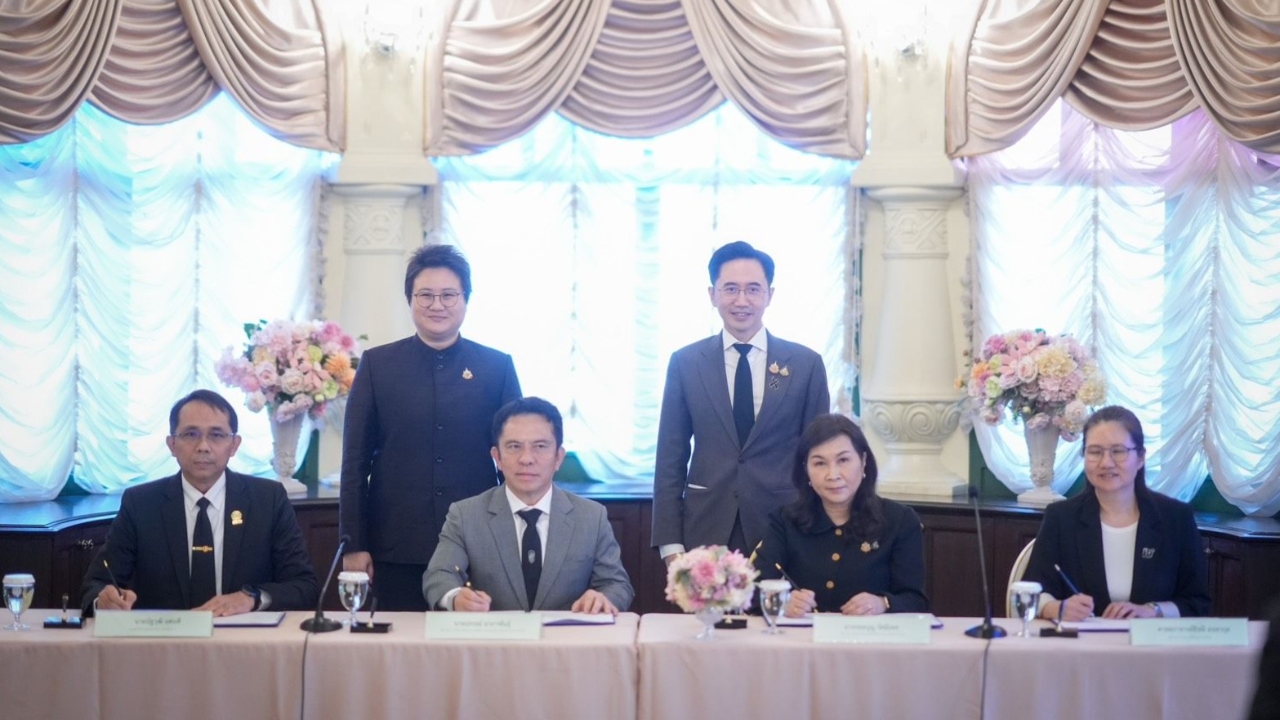
Learning from Nan's flooding, MHESI and DES signed an MOU with four government agencies to accelerate the creation of 'One Water Map,' breaking down conflicting data barriers and launching an early warning dashboard to enhance disaster response accuracy and timeliness. Tags: [Flood Management, Government Collaboration, Disaster Preparedness, Data Integration]
On 15 Sep 2026 GMT+7, at the Government House, Professor Dr. Yoschanan Wongsawat, Deputy Prime Minister and Minister of Higher Education, Science, Research and Innovation (MHESI), together with Ms. Boonthida Somchai, Deputy Minister of Digital Economy and Society (DES), co-chaired the signing ceremony of a Memorandum of Understanding (MOU) among four key agencies to expedite the creation of the 'One Water Map.'Tags: [Government House, MOU Signing, MHESI, DES]
Professor Dr. Yoschanan revealed that this collaboration arose from directing flood response operations in Nan province, where a major issue was identified: Thailand's warning systems contain scattered and inconsistent data among agencies, causing delays in decision-making.Tags: [Flood Response, Nan Province, Data Inconsistency, Disaster Management]
“The greatest challenge is not issuing orders but answering simple questions like where the flooding will occur, how high it will be, and when it will arrive, because each agency’s data differs. Today, we must create the One Water Map so all agencies see the same picture, use the same map, and communicate the same messages to the public—not issuing separate warnings and leaving people guessing whom to trust,” said Professor Dr. Yoschanan.Tags: [Unified Data, Public Communication, Flood Forecasting, Disaster Coordination]

Ms. Boonthida Somchai, Deputy Minister of DES, emphasized the importance of this collaboration: “This MOU marks the first step in integrating critical data nationwide. When data is ready, preparation and manpower deployment can be timely, enabling the government to coordinate responses effectively, assist the people promptly, and reduce damage.”Tags: [Data Integration, Government Response, Disaster Preparedness, Damage Reduction]
This signing represents inter-ministerial cooperation to integrate meteorological, geospatial, water situation, and Big Data/AI information into a National Water Data Repository. The public can now monitor situations through a centralized warning dashboard at www.thaiwater.net/new4all. The four main agencies have clearly defined roles as follows:Tags: [Inter-ministerial Cooperation, Data Integration, Public Access, National Water Data]
Meteorological Department: Provides measurement data, weather forecasts, radar information, and serves as the official agency issuing formal warnings for storms and heavy rainfall.Tags: [Meteorological Data, Weather Forecast, Official Warnings]
Geo-Informatics and Space Technology Development Agency (GISTDA): Supplies satellite imagery, geospatial data, monitors hotspot locations, and PM2.5 conditions to assess risk areas.Tags: [Satellite Imagery, Geospatial Data, Air Quality Monitoring, Risk Assessment]
Hydro and Agro Informatics Institute (HAII): Provides water level and volume data from automatic telemetric stations, assesses rainfall risk areas 24-48 hours in advance, and consolidates data into the National Water Data Repository.Tags: [Water Monitoring, Rainfall Forecasting, Data Consolidation]
Big Data Institute (BDI): Responsible for developing data analysis systems and dashboards, managing data governance, and applying artificial intelligence (AI) to support disaster management.Tags: [Big Data Analytics, Dashboard Development, Data Governance, AI Applications]
In closing, the Deputy Prime Minister stressed that the ultimate goal is not to have the most data or the most advanced technology, but to rapidly identify risks and conduct comprehensive analyses to enable the public to evacuate and prepare in time before flooding arrives, thereby establishing sustainable security for lives and property.Tags: [Risk Assessment, Early Warning, Public Safety, Disaster Resilience]


