GISTDA has released high-resolution satellite images of Hat Yai showing a clear increase in dry areas, with many main roads beginning to reopen.
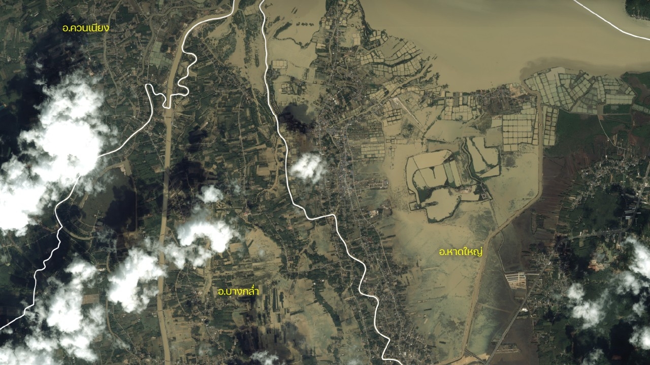
On 1 December 2025, the fan pageof GISTDA, the Geo-Informatics and Space Technology Development Agency (Public Organization),published high-resolution satellite images from Pléiades captured on 1 December 2025 at 10:53 a.m., showing a continuous decline in flooded areas in Khuan Niang, Bang Klam, and Hat Yai districts of Songkhla Province, with a noticeable increase in dry land compared to previous days.
This situation comes amid ongoing efforts by local and government agencies to pump and drain water from communities, especially in low-lying areas such as Khlong Rian, Khlong Hoi Khong, Ban Na Khuan, and the economic zone of Hat Yai district, which were affected by heavy rains over the past week causing flash floods in some spots. While many main roads have reopened, some alleys and villages still require close monitoring.
The spatial data from GISTDA's satellite images serve as a crucial tool enabling local agencies to accurately assess flooding at specific locations, identifying areas where water has receded, areas still flooded, and trends in flood expansion or contraction. This information is essential for coordinating relief teams, delivering food and medicine, caring for vulnerable groups, and restoring critical infrastructure in affected areas.
GISTDA stated that this Pléiades image set and flood analysis have been forwarded to key relevant agencies to serve as a data foundation for planning and decision-making for efficient disaster response. It also supports long-term impact assessments on agriculture, water sources, and communities.
Although flood conditions in Khuan Niang, Bang Klam, and Hat Yai districts are showing signs of improvement, agencies remain vigilant due to unstable weather and the risk of rainfall later in the week, which could affect water levels in the Khlong U-Taphao basin, the main water artery of Hat Yai city.
You can monitor and check flood conditions through GISTDA's main channels: