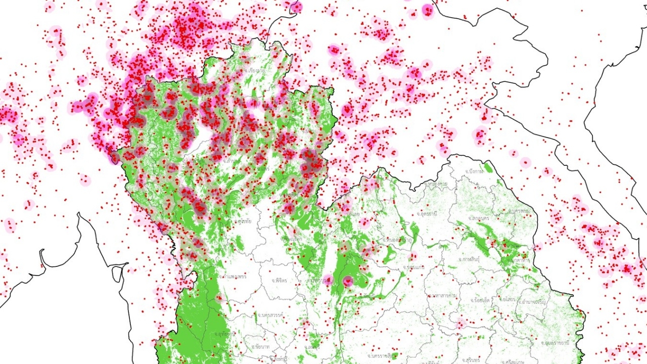
GISTDA reports"hotspots"from datasatelliteSuomi NPP satellite data on 30 Mar 2026 shows Thailand's hotspots surged to a new high of 4,750, with the highest number—2,553—located in protected forest areas.
On 31 March 2026, the Facebook page "GISTDA Space Technology and Geoinformatics Development Agency (Public Organization)" posted a report on hotspots from satellite data. Yesterday (30 March 2026), Thailand's hotspots surged to a new high of 4,750 points.
Data from the Suomi NPP satellite's VIIRS system indicated that Thailand's hotspots occurred as follows: 2,553 in protected forest areas, 1,717 in national reserved forests, 187 in agricultural areas, 161 in Sor Por Kor zones, 125 in community and other areas, and 7 along highway margins.
Meanwhile, neighboring countries recorded their highest hotspot counts as follows: Myanmar 5,505 points, Laos 2,704 points, Cambodia 593 points, Vietnam 489 points, and Malaysia 51 points.
For more details, visithttps://disaster.gistda.or.th/fire
Information courtesy of the Facebook page of GISTDA Space Technology and Geoinformatics Development Agency (Public Organization).