GISDA has released a satellite map showing the Hat Yai flood crisis after 4 days, with over 50,000 rai flooded and water depths exceeding 4 meters, affecting more than 150,000 people.
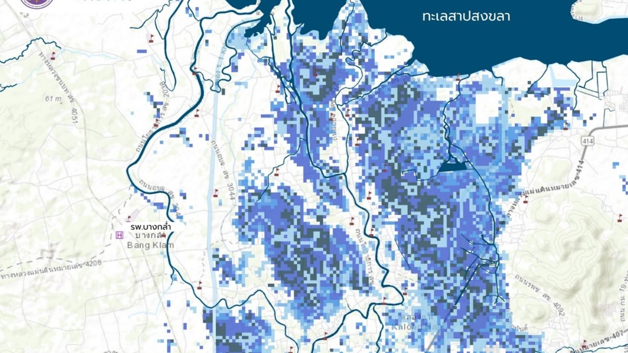
Today (25 Nov 2025 GMT+7) The Geo-Informatics and Space Technology Development Agency (Public Organization) / GISDA revealed the analysis of flooding in Hat Yai District, Songkhla Province, using the HAND Model (Height Above Nearest Drainage) combined with Sentinel-1A satellite data from 24 November 2025 to assess water depth, supporting agencies involved in helping the affected population.

The analysis shows severe and widespread damage, especially to infrastructure and residents' livelihoods in the area, detailed as follows:
- Population affected: approximately 150,230 people
- Housing: over 25,102 households impacted
- Schools: 47 affected
- Hospitals: 8 affected
- Transportation routes: over 536 km impacted in total
Most critical flood areas are shown in dark blue zones, indicating water depths of 2-3 meters, enough to submerge heads, while some very dark or nearly black zones indicate water depths exceeding 4 meters.
Meanwhile, GISDA's satellite map shows the real-time flooding situation as ofGISDAat 13:45 today (28 Nov 2025 GMT+7), revealing that in Songkhla Province, a total of 146,000 rai is flooded, affecting 200,000 people and 30,000 homes. The five districts with the highest flood levels are:
1. Hat Yai: 52,731 rai
2. Ranot: 35,615 rai
3. Bang Klam: 14,153 rai
4. Chana: 13,678 rai
5. Sadao: 5,733 rai