

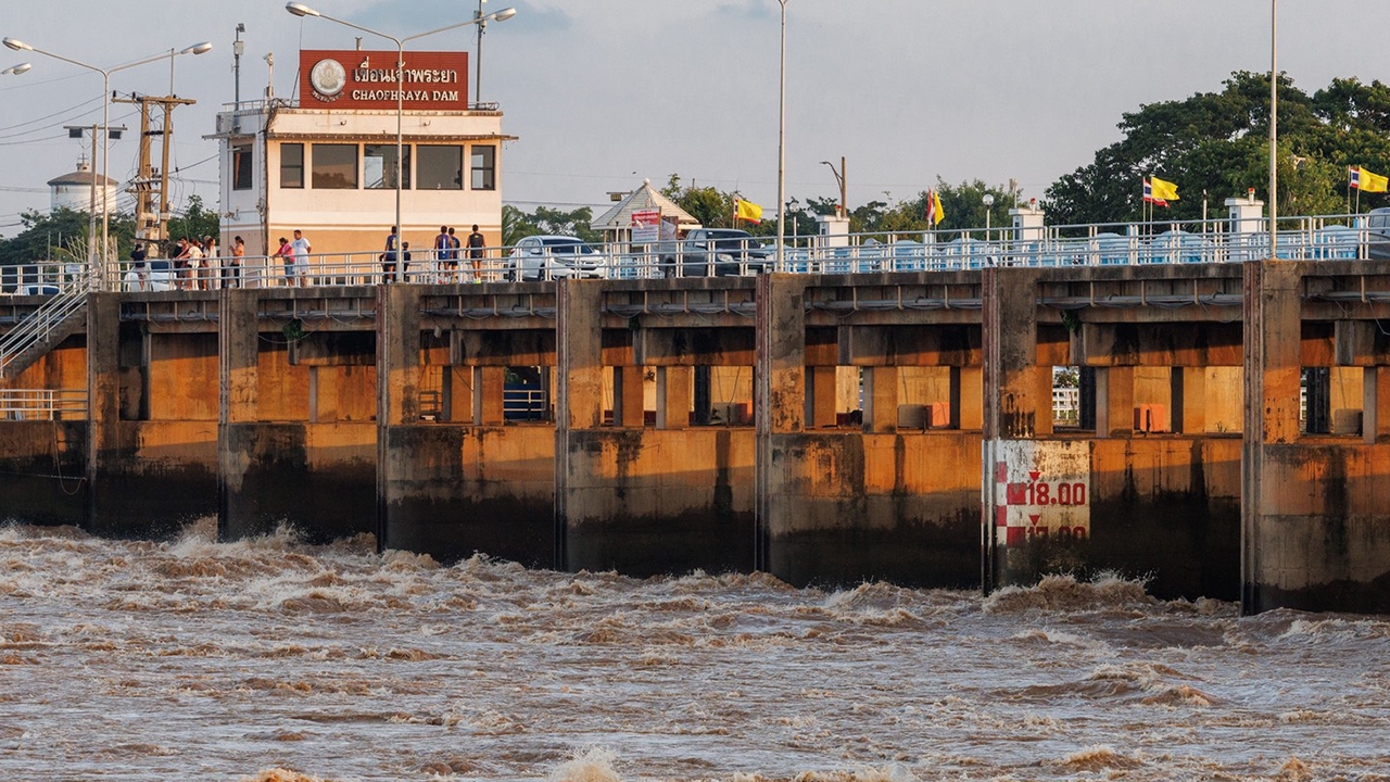
As the rainy season nears its end, the term "Chao Phraya Dam" is often mentioned daily in the news as a key factor determining whether the lower Chao Phraya basin, including Bangkok and its metropolitan area, will face flooding.

The Chao Phraya Dam, located in Sapphaya District, Chai Nat Province, is Thailand's first large diversion dam, operational since 1957.
Many may mistakenly think the Chao Phraya Dam is a large storage dam like Bhumibol or Sirikit dams. In reality, it is a "diversion dam" with the main function of raising water levels upstream and diverting water into irrigation systems on both the west and east sides (via Makham Thao-U Thong Canal, Tha Chin River, Noi River, Chai Nat-Pasak Canal, etc.) for agriculture and domestic use.
Reservoir capacity: As a diversion dam, the water volume in front of the dam is very limited, approximately 100 to 200 million cubic meters only.
Its mechanism is not to "store massive water volumes" but to act as a "water traffic valve," cutting peak flows to the left and right and controlling the volume flowing directly through the dam to downstream areas.

Water masses from the north passing the C.2 monitoring point in Nakhon Sawan Province converge in front of the Chao Phraya Dam. Without effective management, all this water would immediately flood Ang Thong, Ayutthaya, Nonthaburi, Pathum Thani, and Bangkok.
Therefore, the Chao Phraya Dam is a "strategic point" where the Royal Irrigation Department manages water by alternately opening and closing 16 sluice gates, combined with diverting water to the west and east sides, to control discharge rates within safe limits for downstream areas.

To assess whether discharge through the Chao Phraya Dam is at a critical level, key statistics can be compared:
Year | Situation and main factors | Water discharge through the Chao Phraya Dam (cubic meters per second) | Impact on Bangkok and metropolitan area |
2011 (Great Flood) | Five consecutive storms entered Thailand; upper dams were full from early season. | 3,600 – over 3,700 | Widespread and prolonged flooding; embankments failed. |
2025 (High Water Year/Accumulated Rainfall) | Storms and monsoon troughs passed through; northern inflow at C.2 Nakhon Sawan nearly 3,000 cubic meters per second. | 2,200 – 2,800 | Lowland areas outside embankments downstream flooded severely, but Bangkok overcame the crisis. |
2026 (Current Year) | Systematic water management with gradual northern water flow. | 1,750 – 2,300 (controlled not to exceed 2,500) | Within watchful limits; Bangkok safe from northern floodwaters. |
In 2011 (Great Flood), the northern water volume was enormous; upper dams were at full capacity. The Chao Phraya Dam had to discharge over 3,600 cubic meters per second, exceeding what the lower Chao Phraya River could handle (approximately 2,500–3,000 cubic meters per second), causing riverbanks to overflow and widespread flooding in Bangkok and its metropolitan areas.
In 2025, accumulated rainfall and northern inflow were substantial, with discharge adjusted up to 2,700–2,800 cubic meters per second, heavily affecting riverside communities outside embankments in Chai Nat, Sing Buri, Ang Thong, and Ayutthaya Provinces. However, due to prior water release in main rivers and canals, Bangkok remained safe.
In 2026 (current year), water volume and management have kept discharge around 1,750–2,300 cubic meters per second. The National Water Command Center aims to limit discharge through the Chao Phraya Dam to no more than 2,500 cubic meters per second, so combined flows with tributaries do not exceed 3,000 cubic meters per second, which is the critical point that Bangkok's embankments can still withstand.