

The erosion of community rights of the "Kuy people" within the That Mueang Chan archaeological site in Sisaket Province, at a time when conservation still prioritizes objects over people rather than human lives.
In front of a house, two feet stand on a narrow road that separates the home from the ancient temple wall, a longstanding landmark of the community. The homeowner is an elderly, slender man, about 81 years old, whose mobility is not a concern. His memory is sharp and his speech clear. He rises and walks out to welcome visitors, offering water and hospitality in a warm manner.
Sao Awsri He is the former headman of Muang Chan, serving from 1999 to 2009. Therefore, if one wants to absorb the history of the ancient Kuy village and its archaeological sites, it would be hard to find a better source than this former village headman.

The ancient Kuy ethnic community is surrounded by a circular moat approximately 400 square meters in diameter. The terrain is flat, with large ponds to the east and south of the community that retain water year-round. This community is recognized as an 'ancient city moat'. Physical evidence clearly shows a system of moats and embankments encircling the community since ancient times, with a circular city layout.
This layout is characteristic of settlement planning from the late prehistoric period through the Dvaravati and ancient Khmer cultural periods. The moats and embankments surrounding Muang Chan are not merely natural remnants but results of ancestral wisdom designed to defend against external threats. At the same time, they function as water management systems by channeling water from nearby natural streams into the moats and ponds, storing water for agriculture and daily consumption, thus sustaining community life throughout the year.
At the center of this moat-surrounded community lies the 'That Mueang Chan archaeological site'. According to modern nation-state territorial delineation, this archaeological site is currently located at Wat Muang Chan (Ban Muang Chan Temple), Muang Chan Subdistrict, Muang Chan District, Sisaket Province, covering about 45 rai and 90 square wah, according to the Muang Chan Subdistrict Municipality website.

"I have seen the That since I was born. My parents told me they saw it when they were born. My grandparents and great-grandparents said they saw it too," said Sao as he skillfully rolled betel nut in his hand before placing it in his mouth.
For Sao, That Mueang Chan is not just an ancient structure in the village center but part of the landscape familiar to him since birth, the backdrop of daily life shared by current and past community members. The relationship between the people and this place has long been ingrained in their daily lives and collective memory.

Devotion to this site is deeply intertwined with the Kuy community's history over many generations. The surrounding area is lowland, with Huai Thap Than stream playing a vital role in community life. This watershed historically formed part of the cultural area of the Kuy ethnic group, stretching from the mouth of Huai Thap Than flowing into the Mun River in the north to the Phanom Dong Rak mountains in the south, with dense Kuy settlements along both sides of the stream across Surin and Sisaket provinces.
Thus, the temple in this ancient community is not merely a religious place but a physical marker reflecting the community's history and antiquity.
When asked about the age of That Mueang Chan, Sao traced back further than his own lifetime.
"I've seen it for 81 years, and my parents died in their nineties."
Sao's account may not specify the exact age of the archaeological site but reveals another layer of the relationship between people and place.
The antiquity of That Mueang Chan exists not only in archaeological evidence but is passed down through generations' memories—from Sao's generation back to his parents and ancestors, the site has been part of the community landscape for many lifetimes.
According to the Fine Arts Department, That Mueang Chan dates back to around the 17th century CE and represents a local blend of Lan Xang and Khmer art. The small viharn (ordination hall) of Ban Muang Chan is in the local Isan style, dating to approximately the 19th century CE.
Documented dates may take us back only to certain historical periods, but for the community, the site's age is measured through everyday life: births, growth, rituals, merit-making, and the continuous return of generations to live alongside it.
"People from Ban Ta Kon come to pay respect at the That here. Our households are believed to be related. Elders tell stories that they used to live together before our ancestors settled in Ban Muang Chan," Sao shared.

The relationship between Muang Chan and Ban Ta Kon extends beyond sharing an archaeological site; it reaches ancestral stories and memories of once living together before establishing separate communities. This connection is maintained through the tradition of visiting That Mueang Chan and shared cultural practices between the two communities.
The tradition ‘Worshipping at That Mueang Chan’ was officially organized in 1997, initially as a joint event between Ban Muang Chan temple, villagers, and Ban Ta Kon community. After the establishment of the subdistrict administrative organization, the event became an official community activity of Muang Chan.
Initially, the ceremony focused mainly on rituals to honor the That, but gradually expanded to include community cultural activities like wearing Kuy traditional costumes, speaking the Kuy language, singing lullabies, and making merit for deceased relatives.
From pilgrimage rituals to the archaeological site, this tradition evolved into a space where the community expresses its identity through language, dress, beliefs, and ancestral memories.
These elements mean That Mueang Chan does not stand isolated among ancient sites but is a convergence point of memories across generations, communities, and times. Thus, the meaning of an archaeological site may not solely depend on its age but on how many people have lived, created memories, and bonded with it, making it part of the community's identity.
Although the relationship between That Mueang Chan and its community has continued for generations without clear boundaries between the archaeological site and residential areas, a new layer of meaning emerged when the state viewed the area through legal frameworks. The boundary between “archaeological site” and “community” was newly drawn in ways unfamiliar to everyday life.
For those born and raised here, that boundary may never have existed daily. Homes, temples, moats, ponds, and surrounding areas formed one landscape. However, the declaration of a protected archaeological zone and land boundaries gave this same area a new status, accompanied by laws, control powers, and land-use restrictions.
Sao was among those who experienced this transition firsthand...

"I was the one who led officials to survey the archaeological site boundary myself."
"At first, when we surveyed, I didn't know much. I went with Pa Sanga and someone from the Fine Arts Department. The officials hinted that this and that were temple zones."
Sao recalled in 1998, when he was assistant village headman, that he and a colleague accompanied Fine Arts Department officials to survey the area before the site was officially registered and its land boundaries set by the department in Sisaket Province.
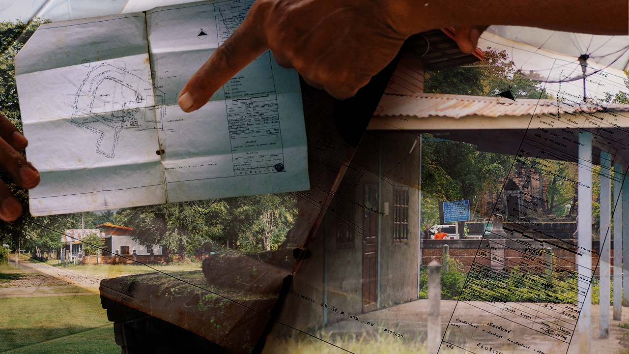
"They sent documents stating the area was over eighty rai," the former headman said, carefully unfolding aged brown papers that indicated their historic nature.

The documents, from the National Archaeological and National Museum Office No. 9 in Phimai District, Nakhon Ratchasima Province, were addressed directly to the then village headman of Muang Chan. They included a Fine Arts Department announcement registering and defining the archaeological site land, dated 10 April 1998, along with a site boundary map.
They specified that Ban Muang Chan covered 86 rai, 2 ngan, and 38 square wah, as Sao described—a heritage site—even though the temple’s specific area is about 45 rai and 90 square wah, as mentioned earlier. This was published in the Royal Gazette, General Announcement, Volume 115, Special Issue 83 Ng, dated 21 September 1998.
"When I became village headman, I told the villagers our village was an archaeological zone. By law, they could decide whether we could live here or not. I explained this to the people."
Though retired since 2009, the title “village headman" still sticks with him. Sao recalled feelings from 28 years ago, expressing ongoing regret as if he had been deceived: "I was the one who led them to survey, and then they told us the houses we live in are not ours."
"But they said we could stay. They weren't going to evict us. So, we just stayed." Jinda Muangchan, the current village headman, added another perspective.
Jinda said that in 2010, when the Fine Arts Department came to restore That Mueang Chan, he asked officials about the entire community’s status as an archaeological site, and they replied, "They won’t evict you; you can stay." This assurance gave Jinda some peace of mind, knowing the community would not be forcibly separated or scattered.

One question remains: If the state does not intend to evict people, why designate residential areas as archaeological sites in the first place?
The registration and land boundary definitions rely on authority under the Ancient Monuments, Antiques, Artifacts and National Museums Act of 1961 and its 1992 amendment. Section 4 defines “archaeological site” as immovable property that, by age, construction style, or historical evidence, has artistic, historical, or archaeological value. This includes archaeological sites, historical sites, and historical parks.
Under this legal definition, the Thai state’s approach to conservation regards archaeological sites not merely as individual old structures but as any immovable property with value from age, construction style, or historical evidence that can be studied for art, history, or archaeology. It also includes sites and parks, preserving the "original" meaning of the area, even if the site’s structures no longer exist and only traces or original locations remain. “Original” here means the legal protection extends to areas where only remains or original locations of sites exist.
The Fine Arts Office Region 7 in Chiang Mai explained that city walls and moats nationwide are not owned by the Fine Arts Department but by the Treasury Department, Ministry of Finance. According to the Treasury Property Act, Section 4, treasury property includes all state immovable assets except for public properties like roads, waterways, riverbanks, and abandoned or expropriated lands.

Thus, city walls and moats, used by the state for defense and boundary marking, are treasury properties owned by the Treasury Department. Since these ancient structures have existed since old times, they also have archaeological site status under the Archaeological Sites Act. This explains why archaeological zone declarations often cover entire villages.
Sarawut Sriwang, a Northeast land rights activist from the People’s Party, who formerly served local government in Sarakamphaeng Yai and Ku subdistricts and worked with communities facing overlapping claims with the Fine Arts Department, explained from his experience that
"I was once informed by Fine Arts officials that the designation is based on the condition of construction and historical context, including components like temples, moats, and barays (water reservoirs). Even before official declarations, the structures and their surroundings are considered archaeological sites by their nature and history."
This clarifies that heritage site boundaries are not considered in isolation but as an interconnected historical area.

However, when these historical areas are inhabited, conservation no longer only protects archaeological value. The moment heritage boundaries cross houses, farmland, or public spaces, laws regulate people’s relationship with the land.
"People settled here before these laws existed. Communities around the temples have lived here for 200-300 years. When the law designates the area as state property and archaeological site, legally they become trespassers on the site," Sarawut explained.
From a legal perspective, the answer is clear when areas are declared archaeological sites. But for those born, raised, and buried here, the term "state property" does not align with their lived experiences.
This gap between perspectives makes conservation not just about preserving the past but raises questions about who defines the meaning of space and the rights of those still living there.
Sarawut then took us to Wat Sa Kamphaeng Yai in Sa Kamphaeng Yai Subdistrict, Uthumphon Phisai District, Sisaket Province, home to Prasat Sa Kamphaeng Yai, another significant provincial landmark located amid a community. Here, "archaeological site" does not only refer to the temple but also relates to housing security for surrounding residents. Within the temple grounds, Prasat Sa Kamphaeng Yai stands prominently in the center—ancient stones weathered over centuries surrounded by a still-active temple. Pavilions around hold Buddha statues visited by worshippers. The sounds of visitors mingle with passing vehicles, as if two time periods overlap on the same land. Across the temple wall, roadside vendors line up selling food, drinks, and goods for visitors and tourists. These scenes do not feel like a frozen heritage site but a living space regularly used.
"When I worked as a government official, some told me to inform villagers that this is an archaeological zone. But I hesitated because legally, the villagers’ legitimacy is strong—the law came after they settled here," Sarawut said.

He recounted receiving similar notices when working as municipal clerk in Sa Kamphaeng Yai and later in Ku District, where Fine Arts officials notified him that the community’s land is linked to an archaeological site.
"They showed me an old map with temple, moat, and pond markings—components of the ancient temple complex," he said.
For Sarawut, these maps reflect how the Fine Arts Department reads the area archaeologically: the temple does not stand alone but includes related structures like moats and barays, all part of the ancient community's structure.
"For example, at Prasat Sa Kamphaeng, they point out the temple, the moat—which on maps covers the entire village—and the baray, now a water reservoir."
"The Fine Arts Department declared the core temple zone of about six rai and three ngan, but outside that, although not officially declared, the area still qualifies as an archaeological site by nature under the law."
The Fine Arts Department
designated the archaeological zone around Prasat Sa Kamphaeng Yai to cover about 6 rai and 3 ngan. The term

"by nature" is key, meaning the boundary lines on official maps are not the only delimiters. Areas outside officially declared zones may still legally be considered part of the archaeological site. As dusk approached, Sarawut toured Sa Kamphaeng Yai village adjacent to the temple. Many residents were unaware their homes are "archaeological sites by nature." Most gathered discussing land tenure problems and the state's failure to issue land titles, a troubling situation if the state later reclaims "state property." Even holding land titles might offer no protection. "Muang Chan villagers somewhat know, but many here do not. I can only inform them slowly, while reminding them of their rights to housing security," Sarawut said.
Returning to Wat Sa Kamphaeng Yai as night fell, only a few lights illuminated a small building where Sarawut introduced us to a thin local man. "This is Uncle Fuang (pseudonym), a local Fine Arts official," Sarawut said, gesturing to him. Uncle Fuang has cared for Prasat Sa Kamphaeng Yai for nine years—cleaning, facilitating visitors, and managing permits for events like filming.
"I maintain and clean the area, mow the grass, explain history to visitors, and oversee events per regulations. Sometimes film crews come in," he said.

These regulations refer to the Ancient Monuments Act, which requires permission before construction, repair, or any activity in archaeological zones. This means Uncle Fuang often faces an additional responsibility:
"absorbing"
the impact of conflicts.
"I do this sincerely. I pay for my own tools. I don’t want to trouble my superiors. The Fine Arts Department can’t be everywhere, but they help mediate in problematic areas. I usually have minor issues but focus on my duties; my bosses trust me," Uncle Fuang said.
While he understands the need for rules and views many problems as small and negotiable, he is often the frontline recipient of tensions caused by regulations and area designations he did not create. Similarly, Prang Ku, another ancient Khmer-style temple over 1,000 years old in Sisaket, reflects complex relationships. The temple stands amidst residential areas where community life continues uninterrupted. Like other sites, the archaeological site is not on empty land but among homes and people. The community around Prang Ku is not officially declared an archaeological zone, but the term "by nature" means the area’s status extends beyond formal boundaries. The law’s perspective may encompass more than what official maps show.

Conservation has its reasons: the past cannot be recreated once lost. But in areas where the past coexists with people, conservation is not on empty land but on someone's home, farmland, and community where generations live.
Sarawut’s advocacy is not about choosing between
"archaeological sites"
and

"people"
but about enabling conservation to coexist with community rights—not viewing conservation solely as protecting objects and forgetting the living communities with shared histories. Hope in the Ethnic Groups Act From That Mueang Chan to Prasat Sa Kamphaeng Yai and Prang Ku, what emerges is not just ancient civilization traces but living people among those traces. Homes, temples, moats, ponds, and ritual spaces are interconnected parts of the landscape passed down through generations. Yet when these areas are interpreted through law, the previously natural relationships become complex. People may be custodians of memory, culture, and pre-law residents, but may also be labeled "trespassers"
"Our ancestors chose to build here because it was suitable—no flooding, fertile land for farming, places for cemeteries and animal grazing. Their wisdom shaped the land according to Kuy ethnic ways. Later, the state designated the land, turning us into trespassers. Legally, that’s how it is," Sarawut said after touring at least three heritage sites with overlapping community claims.
Sarawut’s words return us to the starting point: before the state designated the area, these people had already built their lives here—selecting land by water levels, soil, and landscape to form a community through accumulated knowledge and experience. This land is rich with Kuy civilization, continuing through traditions and adaptations seen in ceremonies passed down to the present. Thus, the question of "who has rights to the land" encompasses not only farming and housing but also the right to determine their community’s future. In land disputes, community rights are often clear in northern ethnic groups like the Karen, where many communities face eviction and restrictions on farming and ritual areas due to state forest or national park declarations, intensified by policies like the NCPO’s forest reclamation.

However, in Sisaket, a similar conflict arises in a different context: the disputing party is not the Department of National Parks but the Fine Arts Department, and the contested land is not forest but moats, ponds, homes, and archaeological sites inhabited for generations.
Though physically distinct, these are essentially the same issues: community rights and housing security of ethnic and local people are equally challenged, only in different regions.
While the Fine Arts Department may not currently enforce harsh eviction measures, and Muang Chan officials once assured community leaders that
"they won’t evict; you can stay,"
revisiting Sao’s words reveals that his lingering concern is not merely fear of eviction but the feeling that his lifelong home has become a place where the state

"permits"
their residence. International human rights principles emphasize the right to housing and protection against forced eviction. The International Covenant on Economic, Social and Cultural Rights (ICESCR) and General Comment No. 7 of the Committee on Economic, Social and Cultural Rights stress that eviction should be a last resort with appropriate safeguards. However, international protections do not automatically translate into daily reality, as Thai law separates international and domestic law, creating a gap between recognized rights and their local implementation. This gap makes "the right to housing" feel distant to those simply wondering if they can stay in their homes tomorrow. On the other hand, the Ethnic Groups Act,
enacted in September 2025, marks a significant milestone in recognizing ethnic groups’ rights and identities—covering lifestyles, culture, language, beliefs—and establishes mechanisms for

"protected areas for ethnic group ways of life"
and community participation in managing their resources. This law is expected to empower ethnic peoples and indigenous groups to have a voice in managing their lives, traditions, and knowledge, rather than passively accepting decisions from central authorities. "I want the Ethnic Groups Act to protect those of us whose ancestors lived here traditionally. We should have the right to safety and security in our homes. Currently, the state unilaterally decides. We, the people, should participate in determining our ways of life and resource allocation. Simply put, we should be able to say we lived here before the law—how can the state just claim it? Having power doesn’t justify that," Sarawut said firmly. For the ancient Kuy community of Ban Muang Chan, their hope is not to revert That Mueang Chan from an "archaeological site"
to just ordinary land, nor to deny the state’s authority to preserve historical heritage. Instead, it is an effort to show that conservation and community survival can coexist, because ultimately, protecting culture cannot be separated from protecting the people who carry that culture.
That Mueang Chan remains because generations have cared for it—not just the Fine Arts Department alone. The pilgrimage tradition continues because the community lives on. If the Kuy language, beliefs, and ways are passed from one generation to another, conservation must include preserving the
"people" who keep the meaning of the past alive. This is the challenge for the Ethnic Groups Act, which must operate amid other laws governing land, such as forestry laws, treasury property law, and the archaeological sites act—each with its own rationale and authority. If these laws continue to work in isolation, community rights questions will be bounced between agencies, leaving locals waiting for answers.

Before leaving Ban Muang Chan, Sao still sat in front of his old home. That Mueang Chan stood behind the temple wall, unmoved, surrounded by villagers’ homes still lined up nearby. Nearly three decades after Sao personally guided officials to survey the land, the archaeological site remains, and so does the community. What remains uncertain is how these two will coexist under what rules. For those born and raised here who have seen That Mueang Chan as far back as memory serves, their presence is not new since the state declared the site, nor should their existence rely on state permission to be meaningful. History is not only in bricks, walls, or artifacts but lives in people’s homes, repeated traditions, spoken language, and memories of people like Sao, who confidently said,
"I have seen the That since I was born."
References:

Ancient Monuments, Antiques, Artifacts and National Museums Act (No. 2) B.E. 2535 (1992)
"That Mueang Chan: Faith, Identity, and the Creation of Local Folk Dance in a Regional Context*" "That Mueang Chan: The Influence of Khmer Architectural Styles in Isan"
"Beliefs in the Creation of Ancient Wooden Buddha Images at Wat Ban Muang Chan, Muang Chan District, Sisaket Province"