

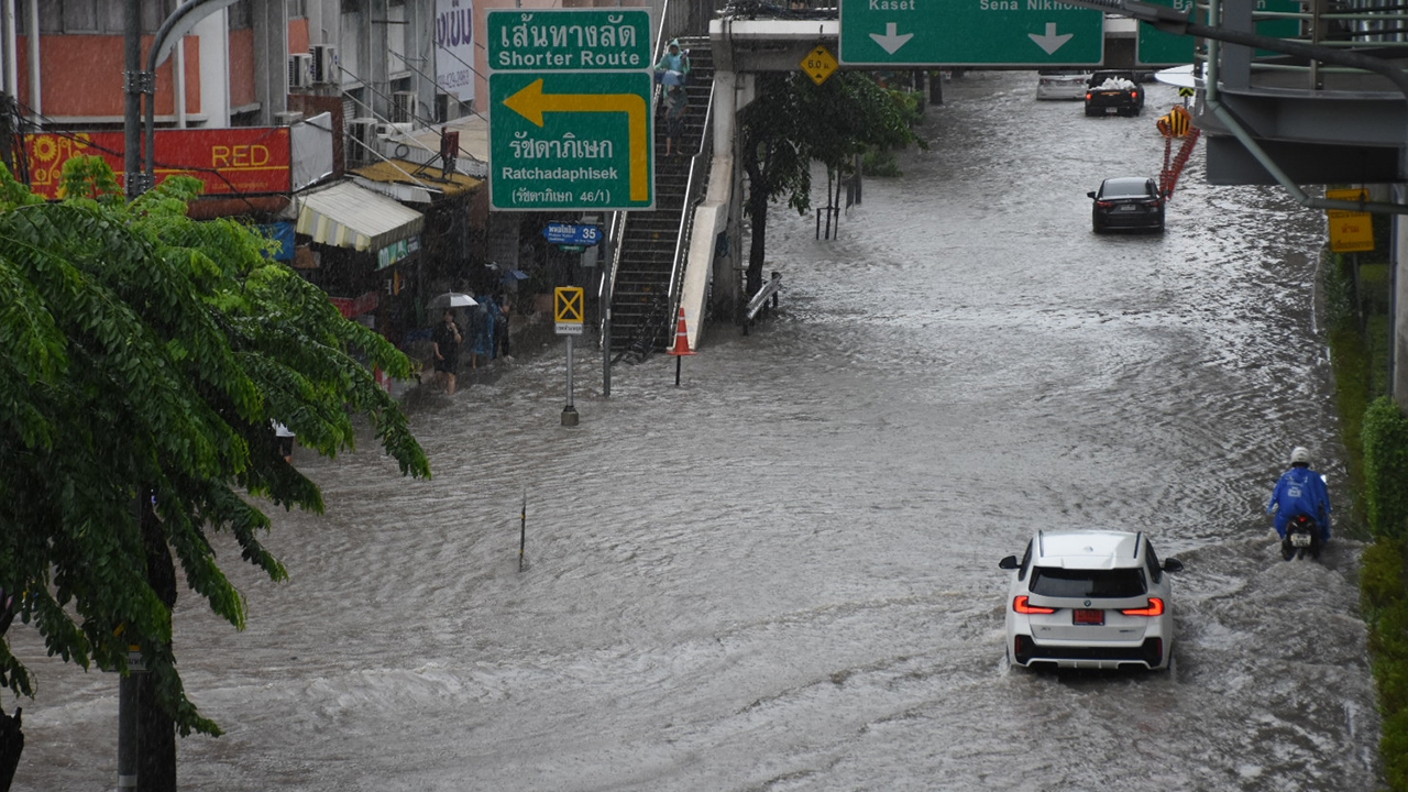
This evening, Bangkok's rainfall is easing, but warnings remain for zones still at risk of flooding. We explain the "stuck rain" phenomenon battering the capital and the Meteorological Department reveals why the rain refuses to move.
It has become a nightmare for Bangkok residents again after continuous heavy rain lasting days caused widespread flooding, electrical hazards, and paralyzed traffic. The Thairath Online special news team directly consulted experts from the Meteorological Department to uncover the true reason why this rain event has "stuck around for days" and what direction the situation will take next. How much longer will Bangkok have to cope?
Sources from the Meteorological Department revealed today's (26 Sep 2023) rain situation: the heavy, persistent rainfall is caused by a "low-pressure area"—a depression-like system—that is swirling and "stuck" precisely over Bangkok and its metropolitan area.
"This kind of 'stuck rain' is rare; it refuses to move, swirling over the same area with no clear direction on where it will go next."

It is expected that by this evening, the system will begin shifting westward and toward central regions, showing signs of rain dispersing.
A detailed look at accumulated rainfall over the past 24 hours shows alarming figures, with Bangkok averaging 100 to 200 millimeters of rain.
The heaviest rainfall was recorded at the Bang Na district monitoring station, measuring 206.6 millimeters—setting the highest 24-hour record.
Areas with heavy accumulated rainfall include Talat Phlu and Thawi Watthana districts and nearby areas, as well as several inner Bangkok locations.
Rainfall exceeding 200 millimeters in a short period surpasses the normal drainage capacity, inevitably causing water to accumulate in many spots awaiting drainage.

Meteorological sources assess that the rain system is moving toward the western zone and continuing to impact areas. The zones requiring "special monitoring" include:
Western Bangkok zone: Thawi Watthana, Bang Khae, Bang Bon, Bang Khun Thian, Nong Khaem, Prawet, and Suan Luang districts.
Nearby metropolitan provinces: Nonthaburi, Pathum Thani, Nakhon Pathom, Samut Sakhon, Samut Prakan, as well as Ratchaburi and Kanchanaburi provinces.
1. This evening, rainfall will begin to ease from "heavy" to "moderate," with amounts dropping to around 30 to 40 millimeters.
2. Forecast for 27-28 September: Rain conditions will improve, with a noticeable decrease in rainfall volume, though some light rain may persist, it will not be as heavy as before.
3. Response capacity: If no new rain systems develop, Bangkok should be able to recover and improve drainage as sea tide levels are not excessively high.
The Meteorological Department urges people traveling during this period to exercise special caution in areas of high flooding, especially:
