

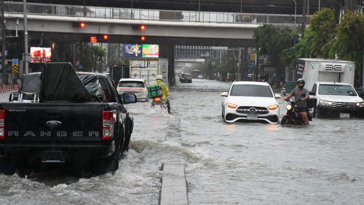
Bangkok is warned to face "three phases of rain." The first phase is expected to begin easing tomorrow, while the second phase at the end of next week will bring less rainfall. Authorities are hoping the third phase will not cause repeated heavy rain. Experts point to a new phenomenon caused by a "rain front collision," where air masses converge from both sides, causing rain clouds to stall and linger, similar to what happens in Japan.
Regarding the heavy rain situation in Bangkok, the Thairath Online special news team consulted Associate Professor Dr. Sujarit Koontanakulwong, a faculty member in the Department of Water Resources Engineering, Faculty of Engineering, Chulalongkorn University, and director of the National Research Office’s water security targeted research program. He explained that the heavy rainfall results from a "rain front collision" or a low-pressure trough formed when monsoon winds bring high moisture from the South China Sea and the Gulf of Thailand, colliding with opposing air masses on both sides. This causes rain clouds to become stationary and accumulate over the same areas, producing heavy and widespread rainfall.
The water level in the Chao Phraya River remains moderate at about 1.5 to 1.6 meters, providing sufficient buffer capacity. This allows continuous drainage of water from canals into the main river.
Points of concern: Although the main river can still handle the water volume, the major issue is "internal waterlogging" in vulnerable areas, which requires time and efficient pumping to drain effectively.

In a worst-case scenario, rainfall is expected to decrease by next week, but weather conditions must be closely monitored. The forecast anticipates continuous rain until next week, especially late in the week (Saturday-Sunday), divided into three stages or "three phases" as follows.
Phase 1: Current situation – accelerated drainage during this week from 25 to 27 September.
Heavy accumulated rain continues, but water levels in the Chao Phraya River remain manageable, allowing ongoing drainage into the main river. Most issues remain localized waterlogging in low-lying areas awaiting drainage.
Phase 2: Northern floodwaters plus new rain expected late next week.
Water discharged from the north will increase from 1,500 to about 1,700 cubic meters per second, raising water levels in the Chao Phraya River. Rainfall is expected to decrease compared to the first phase, but riverside and vulnerable canal areas will begin to be affected.
Phase 3: Crisis risk of expanded flooding expected 8–11 October.
If northern water releases increase above 2,000 cubic meters per second, combined with continuous heavy rain, the Chao Phraya River’s water level will rise significantly, slowing drainage. Areas that have never flooded or riverside zones face high risk of immediate flooding.
This phenomenon is a rare weather occurrence in Thailand caused by the collision of two air systems. However, weather conditions can still change. If rain clusters move northward instead, Bangkok may avoid a crisis during the third phase, so close monitoring remains essential.
How should Bangkok residents prepare?
1. Monitor news closely, including alerts and rain cluster locations from the Meteorological Department and Bangkok Metropolitan Administration.
2. Elevate belongings for homes in low-lying areas, near canals, or along the Chao Phraya River to prevent damage.
3. Plan travel and work arrangements, including shifting to Work From Home (WFH) if possible, to reduce traffic congestion and avoid being stranded during heavy rain.

Dr. Seri Supharat, Director of the Climate Change and Disaster Center at Rangsit University, revealed that rainfall in Bangkok is unusually high. Since 24 September, accumulated rainfall has exceeded 200 mm and is expected to surpass 300 mm soon. According to the Meteorological Department’s criteria, 24-hour rainfall exceeding 91 mm is considered very heavy rain with high flood risk.
In many parts of Bangkok, even 60 mm of rain can cause waterlogging. The widespread flooding results from heavy accumulated rain. The severity appears worse due to lack of risk assessment, which is the responsibility of local agencies to evaluate which areas will flood if rainfall exceeds 300 mm, enabling preparation and warning, and ensuring sufficient and properly positioned water pumps.
"Each locality must monitor announcements from the Meteorological Department and the warning center about the overall flood situation and assess their capacity to handle water volumes. Pumps may need to be relocated as necessary. Currently, although the Chao Phraya River water level is high, it has not breached the embankments and can still accommodate water."
It is expected that the crisis point in Bangkok and surrounding areas has passed. From this afternoon (25 Sept) through tomorrow (26 Sept), hourly rainfall is expected to decrease, improving the situation gradually. The next area to monitor is the western region, where the Mae Klong River basin can still handle water well. However, concerns remain for tributaries and canals, especially in hillside areas.
Associate Professor Dr. Seri concluded by advising Bangkok residents not to panic. This event differs from the 2011 major floods caused by northern water surges, which took up to three months to resolve. The current flooding is due to local heavy rainfall causing waterlogging and canal overflow. If drainage is effective, flooding should last no longer than one week. He urged people to closely follow updates and avoid travel to prevent vehicle damage.