

Promoting the 'sponge city' concept, experts see three long-term solutions to Bangkok's flooding, ranging from urban planning to national infrastructure, while noting weaknesses in public-private collaboration.
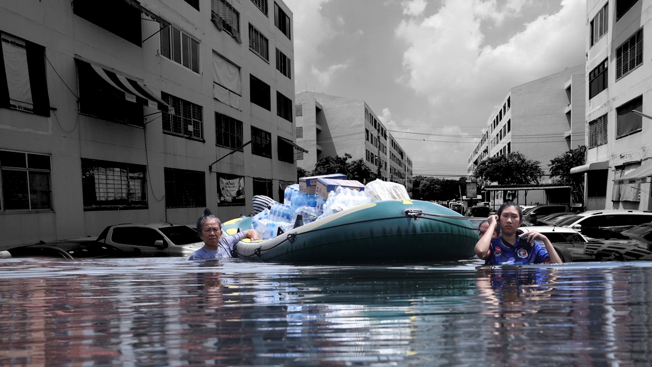
Following continuous heavy rainfall in Bangkok and nearby provinces, although the rain has stopped, water remains pooled, severely impacting daily life in many areas such as Lat Phrao and Bang Kapi, where water levels exceed 1.3 meters and some roads are partially closed.
Thairath Online's special report interviewed Associate Professor Anek Siripanichkul, an expert in civil engineering and president of the Engineering Institute of Thailand under Royal Patronage (EIT). He explained that this flood is "surface runoff" caused by accumulated rainfall flowing over land, unlike the 2011 flood which was caused by river overflow. Water cannot drain effectively. If upstream water joins the already accumulated rainwater, the situation could worsen. However, Bangkok has embankments along the Chao Phraya River and connected canals up to the eastern flood barrier, about 2.5 to 3 meters above sea level, preventing external water from flooding the inner economic areas.

At the same time, Associate Professor Anek questioned why Lat Phrao, a key area in the 2011 flood, failed to drain water now. The canal width and rights have narrowed drastically from about 60 meters to only 20–25 meters, reducing capacity to receive and drain water. Government offices and agencies along the roads pump water from their areas onto main roads, causing rapid flooding, such as on Chaeng Watthana Road.
The lack of laws prohibiting landfills in flood barrier areas has led to individuals raising their land levels to protect their homes from flooding. When floods come, water has nowhere to go and quickly floods other areas. Without landfills, all areas would share water absorption, preventing any one home from bearing the burden alone. Building construction and concrete surfaces increase runoff speed and volume, unlike natural ground which absorbs water.
Associate Professor Anek suggests creating retention ponds or underground water tanks in buildings, new houses, and projects, reserving 10% of space for water storage. Large buildings or condos should expand water storage capacity. The government could offer incentives such as tax breaks or allow increased building area (from 4 times to 5–6 times floor area ratio). Use permeable materials like pervious concrete or grass-block pavers around buildings to allow immediate rainwater absorption. Government offices should store rainwater onsite before gradually pumping it out when streets dry. After floods recede, agencies must promptly remove sandbags and large bags to prevent them from blocking drainage. Pump systems should be managed with a "wet-dry alternation" approach, releasing water at set times and pumping it out in the morning to keep roads dry and usable, rather than solely blocking water.

Using sandbags or water bags to raise external water levels increases water pressure beneath floors, risking structural damage. Allowing some water (about 20 cm) inside homes can balance pressure, with water above helping counteract underground water pressure.
The news team also interviewed Associate Professor Dr. Sujarit Koonthanakulwong, Deputy Dean and faculty member of the Water Resources Engineering Department, Faculty of Engineering, Chulalongkorn University. He said the main factor is the exceptionally high accumulated rainfall over 300 millimeters. Normally, Bangkok's drainage system is designed to handle up to 60–80 millimeters of rain. Beyond that, water overflows and floods roads immediately. In the past, heavy rain usually lasted only 3–4 hours in the evening, allowing pumps to manage drainage. This time, heavy rain covered all districts continuously for two days and nights, leaving no time for the system to recover or drain water adequately.
Importantly, the Chao Phraya River's water level remains below flood barriers, but severe flooding arose from canals overflowing and slow drainage. Heavily affected areas are often far from the river, such as Thonburi's Phutthamonthon areas 4 and 5, and eastern Bangkok zones like Min Buri, Khlong Sam Wa, and Bang Khen roundabout. Water takes longer to travel through canals to the river. Central city areas or those adjacent to the river, such as Yaowarat or inner Phra Nakhon, suffered less flooding as water drains directly into the river.
Water flow follows four stages: roads, drainage pipes, canals, and the Chao Phraya River. Limitations exist in slope and pumping capacity. Currently, Bangkok's total pumping capacity is about 1,200 cubic meters per second, sufficient for typical heavy rain (around 100 millimeters). However, when rainfall reaches 300 millimeters, water volume triples, demanding triple pumping capacity. The existing system cannot cope. Rapid urban growth and high land prices have led to development of vacant land, thick soil, or natural water retention basins into buildings, depriving the city of natural "sponges" to absorb rainwater into the ground.

Systematically opening and closing floodgates to direct water flow away from dense economic or community areas. Improving warning systems with detailed spatial information and precise water level forecasts, for example, issuing two-hour advance warnings for 50-centimeter flooding at locations like the Royal Plaza or Ramkhamhaeng Road. This enables people and businesses to prepare by moving valuables to higher ground, relocating vehicles from risk zones, or shifting to Work from Home (WFH) to ease traffic and hazards.

Converting large parks like Lumphini Park or urban ponds into temporary water retention areas (floodable for one day) to reduce peak water volume before releasing into canals. Encouraging homes and large buildings to install rainwater tanks or retention decks to temporarily store rainwater, releasing it gradually after rain stops. Reducing fully paved concrete surfaces, replacing them with grass blocks or lawns to allow soil to absorb rainwater.
Proposing investment in large diversion canals to redirect water from northern and central regions (e.g., Chai Nat–Pasak route) directly to the Gulf of Thailand near Bang Pakong, so water does not have to pass solely through the Chao Phraya River and Bangkok. If successful, this will increase overall drainage capacity to 4,000 cubic meters per second, sustainably reducing flood risks regionally and in Bangkok. Changing laws on compensation payments in water retention or flood-prone areas (such as Bang Ban, Phak Hai districts, or Nong Chok district) from post-disaster damage payments to fair land-use compensation for water retention areas (e.g., 4,000 baht per rai), fostering cooperation and consent between government and local residents.